Area Overview for NR12 8YL
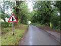
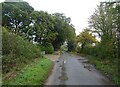
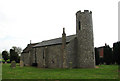
Photos of NR12 8YL

Area Information
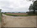
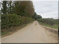
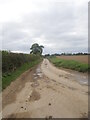
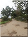
NR12 8YL represents a specific residential cluster covering just 26.5 hectares in Norfolk, England. This small postcode area serves a population of 2,298 residents, resulting in a population density of 154 people per square kilometre. You will find a tightly knit community where daily life unfolds in a compact setting that avoids the sprawl of larger urban centres. The area functions as a quiet neighbourhood where specific local habits and geography define the rhythm of the day. Living in NR12 8YL means navigating a space defined by its modest footprint and established residential nature. The layout supports a lifestyle centred on proximity to local nodes rather than extensive urban infrastructure. This postcode covers a defined group of homes where neighbours are likely to know one another due to the limited physical footprint. You gain the benefit of a stable environment without the congestion found in more densely populated zones to the east. The area offers a snapshot of traditional market town living accessible from the broader Norfolk region.
- Area Type
- Postcode
- Area Size
- 26.5 hectares
- Population
- 2298
- Population Density
- 154 people/km²
The property market in NR12 8YL is characterised by established ownership rather than new developments or buy-to-let schemes. With 74% of residents owning their homes, this area functions primarily as an owner-occupied community. You will encounter a stock dominated by houses, reflecting the historical development patterns of this rural postcode. Buying homes in NR12 8YL offers the advantage of joining a settled population with deep roots in the locality. The low density of 154 people per square kilometre means you are purchasing space rather than fighting for city centre premiums. The housing stock consists almost exclusively of houses, providing the structural variety found in village living rather than the uniform blocks of social housing or student accommodation. This market segment appeals to those seeking independence and quiet. The high level of owner occupation indicates that properties are often passed down or bought for long-term living purposes. You are likely to find homes in good repair with established gardens. The small area size of 26.5 hectares limits new supply, which can maintain property values but may restrict availability for immediate purchase.
House Prices in NR12 8YL
Showing 21 properties
| Address | Type | Beds | Baths | Last Sale Price | Last Sale Date | |
|---|---|---|---|---|---|---|
| Harrodan, 1 Church Road, Ashmanhaugh, NR12 8YL | Semi-detached | 3 | 2 | £287,500 | Sep 2025 | |
| Holly Cottage, Church Road, Ashmanhaugh, NR12 8YL | Detached | 4 | 2 | £550,000 | Apr 2024 | |
| Glebe House, Church Road, Ashmanhaugh, NR12 8YL | house | - | - | £410,000 | Apr 2019 | |
| Meadow Cottage, Church Road, Ashmanhaugh, NR12 8YL | Semi-detached | 3 | 1 | £270,000 | Nov 2016 | |
| Rose Cottage, Church Road, Ashmanhaugh, NR12 8YL | Cottage | 3 | - | £390,000 | Aug 2014 | |
| 38 Church Road, Ashmanhaugh, NR12 8YL | Cottage | 3 | - | £150,000 | May 2013 | |
| Church Farm, Church Road, Ashmanhaugh, NR12 8YL | Bungalow | - | - | £335,000 | Jul 2004 | |
| Corner Cottage, Church Road, Ashmanhaugh, NR12 8YL | Semi-detached | 3 | 1 | £190,000 | Dec 2003 | |
| Charnwood Cottage, Church Road, Ashmanhaugh, NR12 8YL | house | - | - | £115,000 | Nov 1999 | |
| 41 Church Road, Ashmanhaugh, NR12 8YL | Semi-detached | - | - | - | - |
Energy Efficiency in NR12 8YL
Daily life in NR12 8YL revolves around a few accessible amenities within practical reach. The nearest major town is Wroxham, providing a metro-style hub for dining, culture, and larger shopping that you might not find locally. A train journey connects you to Wroxham and other transport nodes four minutes away by rail line. For everyday shopping needs, Tesco Norwich and Morrisons Daily stores are available nearby. These retail locations offer supermarkets and essential goods without requiring a long drive. You will find five significant retail points in the immediate vicinity, covering most daily requirements. Morrisons Daily appears twice in the list due to local presence, suggesting multiple convenient outlets for grocers. The area balances rural quiet with necessary conveniences. While the cluster is small at 26.5 hectares, the transport network prevents total isolation. You do not live in a void but rather in a connected neighbourhood. The availability of rail stations like Hoveton & Wroxham ensures you can reach wider opportunities. This mix of local shops and easy rail access defines the lifestyle for residents.
Amenities
Schools
Families residing in this postcode have access to several educational institutions nearby, including St John's Community Primary School and Nursery. This primary school holds an Ofsted rating of good, confirming a standard of education that meets government expectations. St John's serves as a key educational anchor for younger children in the vicinity. Beyond primary education, Broadland High Ormiston Academy stands as a prominent senior school option. While this academy provides secondary education, the data does not specify its current Ofsted rating, though it represents a significant resource for pupils from the wider region. Broadland High School also appears in the list of local institutions, offering further primary education options should St John's be unsuitable. The mix of academy trusts and community-run schools like St John's provides variety in educational philosophy. Students benefit from a system that includes academies, a nationally mandated funding model, alongside traditional community schools. You do not need to travel far for education, as these schools are located near NR12 8YL. The presence of a nursery within St John's ensures the entire schooling journey can begin close to home.
| Rank | School | Type | Entry gender | Ages |
|---|
Explore more schools in this area
Go to Schools tabDemographics
The community in NR12 8YL is distinctly mature, with a median age of 47 years. The most common age range among residents consists of elderly people aged 65 and over, indicating a settlement that has seen significant demographic shifts towards retirement housing. This area is predominantly White, reflecting the broader ethnic composition of the surrounding Norfolk countryside and market towns. Home ownership is a defining feature of this neighbourhood, with 74% of households owning their property. This high rate suggests stability and long-term settlement rather than a transient rental market. Almost all residential units are houses, and you will not find flats or townhouses as significant components of the stock. The accommodation type aligns perfectly with the age profile, offering detached or semi-detached properties suitable for families or downsizers. There is no significant deprivation data available to provide a full economic picture, but the high ownership rate generally suggests financial security among residents. The area lacks the diversity found in major metropolitan hubs, focusing instead on a traditional demographic structure common in rural England.
Household Size
Accommodation Type
Tenure
Ethnic Group
Religion
Household Composition
Age
Household Deprivation
NS-SEC
Explore more demographic insights in this area
Go to Demographics tabPlanning
Planning Constraints
- Flood RiskPremium
- Ramsar Wetland SitesPremium
- Area of Outstanding Natural BeautyPremium
- Protected Nature ReservePremium
- Protected WoodlandPremium