Area Overview for NR12 8PP
Photos of NR12 8PP
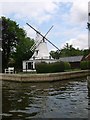


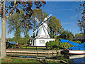
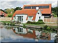
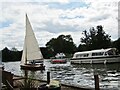
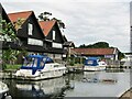
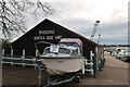
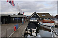
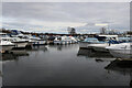
65 photos from this area
Area Information
Key information about the NR12 8PP including its size, population, and administrative classification.
- Area Type
- Postcode
- Area Size
- 11.9 hectares
- Population
- 1475
- Population Density
- 43 people/km²
House Prices in NR12 8PP
10
Properties
£837,200
Average Sold Price
£550,000
Lowest Price
£1,100,000
Highest Price
Showing 10 properties
| Address | Type | Beds | Baths | Last Sale Price | Last Sale Date | |
|---|---|---|---|---|---|---|
| Coot Cottage, Ferry Cott Lane, Horning, NR12 8PP | Bungalow | 3 | - | £1,025,000 | Feb 2025 | |
| Owls Dene, Ferry Cott Lane, Horning, NR12 8PP | Detached | 4 | 3 | £1,100,000 | Jun 2024 | |
| Willow Lodge, Ferry Cott Lane, Horning, NR12 8PP | Detached | 3 | 1 | £820,000 | Sep 2020 | |
| Otters, Ferry Cott Lane, Horning, NR12 8PP | Detached | 3 | 3 | £550,000 | Apr 2010 | |
| Wiluna, Ferry Cott Lane, Horning, NR12 8PP | Detached | - | - | £691,000 | May 2005 | |
| Ranworth House, The Moorings, Ferry Cott Lane, Horning, NR12 8PP | Semi-detached | 3 | 3 | - | - | |
| Barton House, The Moorings, Ferry Cott Lane, Horning, NR12 8PP | Semi-detached | 4 | 3 | - | - | |
| Branksome, Ferry Cott Lane, Horning, NR12 8PP | Detached | 3 | 3 | - | - | |
| Hickling House, The Moorings, Ferry Cott Lane, Horning, NR12 8PP | Detached | - | - | - | - | |
| Alderfen House, The Moorings, Ferry Cott Lane, Horning, NR12 8PP | Terraced | - | - | - | - |
Energy Efficiency in NR12 8PP
Amenities
Schools
| Rank | School | Type | Entry gender | Ages |
|---|
Explore more schools in this area
Go to Schools tabDemographics
Household Size
Two person
most common
Accommodation Type
Houses
most common
Tenure
75
majority
Ethnic Group
White
most common
Religion
N/A
most common
Household Composition
N/A
most common
Age
47
median
Adults (30-64 years)
most common
Household Deprivation
N/A
with no deprivation
NS-SEC
38
in Lower managerial occupations
Explore more demographic insights in this area
Go to Demographics tabPlanning
Planning Constraints
- Flood RiskPremium
- Ramsar Wetland SitesPremium
- Area of Outstanding Natural BeautyPremium
- Protected Nature ReservePremium
- Protected WoodlandPremium