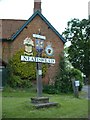
Area Overview for NR12 8EW
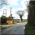
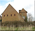
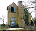
Photos of NR12 8EW

Area Information
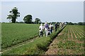
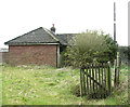
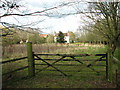
Living in the NR12 8EW postcode offers a quiet residential experience centred around a cluster of just 3.3 hectares. With a population of 2,061, this small area feels intimate and manageable. The specific geography creates a settled environment where neighbours often know each other. This locality sits well outside the intense hustle of Norwich city centre yet remains linked to surrounding towns. Residents enjoy a low-density setting that prioritises peace over urban convenience. The neighbourhood is defined by its compact size, which limits through-traffic and maintains a consistent neighbourhood character. Daily life here revolves around local interaction and access to services just beyond the immediate boundary.
- Area Type
- Postcode
- Area Size
- 3.3 hectares
- Population
- 2061
- Population Density
- 71 people/km²
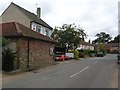
You will find that NR12 8EW is overwhelmingly an owner-occupied market. The data confirms a 78% home-ownership rate, meaning rentals are a minority housing option. Houses dominate the local accommodation stock, so you will not typically encounter high-rise blocks or purpose-built flats within this postcode. This layout suits families and couples seeking garden space rather than low-maintenance apartments. For buyers looking at homes in NR12 8EW, the supply will focus on detached or semi-detached properties rather than converted urban units. The area serves as a small residential cluster where long-term residents have established roots.
House Prices in NR12 8EW
Showing 2 properties
| Address | Type | Beds | Baths | Last Sale Price | Last Sale Date | |
|---|---|---|---|---|---|---|
| Charles House, School Lane, Neatishead, NR12 8EW | Detached | 4 | 2 | £425,000 | Apr 2008 | |
| Ellsworth House, School Lane, Neatishead, NR12 8EW | Detached | - | - | £397,500 | Feb 2008 |
Energy Efficiency in NR12 8EW
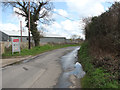
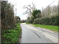
Daily life in NR12 8EW relies on accessible amenities within a reasonable travel radius. Three railway stations sit within practical reach, including Hoveton & Wroxham Railway Station and Worstead Railway Station. Salhouse Railway Station also provides rail links for commuting. For daily shopping needs, Tesco Norwich and Morrisons Daily are the notable supermarkets residents utilise. Wroxham acts as the nearest metro link, offering broader access to city centres and leisure facilities. This combination of rail access and supermarket availability means you do not need a car for all weekly essentials. Local life balances rural quiet with reasonable access to retail and transport nodes.
Amenities
Schools
Families considering schools near NR12 8EW have two strong options identified within practical reach. Horning Community Primary School operates with a Ofsted rating of good. Neatishead Church of England Primary School holds an outstanding Ofsted rating. Both institutions serve the primary education age group effectively. The mix of ratings suggests a solid educational foundation for children growing up in the area. Parents can choose between a maintained community school or a well-rated church of England primary. These two venues provide continuous coverage for young learners in the locality without needing to travel extensively to other towns.
| Rank | School | Type | Entry gender | Ages |
|---|
Explore more schools in this area
Go to Schools tabDemographics
The community in NR12 8EW is mature, with a median age of 47 years. Most residents fall into the 30 to 64-year-old bracket, suggesting a stable workforce rather than a transient student population. Over 78% of households own their homes completely or with a mortgage, indicating a foothold in a property market. Houses form the predominant accommodation type, reflecting family-oriented living standards. The predominant ethnic group within the area is White, mirroring the broader East Anglia demographic profile. This age profile often correlates with higher employment stability and fewer young children competing for local primary school spaces immediately within the cluster.
Household Size
Accommodation Type
Tenure
Ethnic Group
Religion
Household Composition
Age
Household Deprivation
NS-SEC
Explore more demographic insights in this area
Go to Demographics tabPlanning
Planning Constraints
- Flood RiskPremium
- Ramsar Wetland SitesPremium
- Area of Outstanding Natural BeautyPremium
- Protected Nature ReservePremium
- Protected WoodlandPremium