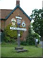
Area Overview for NR12 8BU
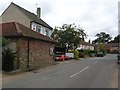
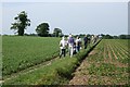
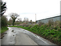
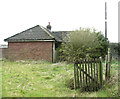
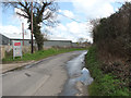
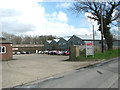
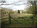
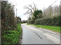
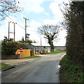
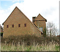
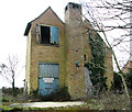
Photos of NR12 8BU
Area Information
Living in NR12 8BU offers a quiet residential experience within a modest cluster covering 9.1 hectares. This postcode hosts a population of 2061 people, creating a neighbourhood with relatively low density. You will find 71 people per square kilometre here, meaning streets are likely uncrowded and the atmosphere remains peaceful. The area is situated in England and functions primarily as a small residential hub for those seeking space and calm rather than urban noise. Daily life here revolves around the immediate surroundings rather than city centres. You will notice a strong sense of local community tied together by shared housing stock and limited traffic. The small footprint means that local events or initiatives can reach households quickly. Residents enjoy a sense of ownership over their immediate environment. The area does not sprawl; instead, it concentrates homes into a tight, manageable footprint. This makes it easy to walk or cycle to nearby points of interest within the town limits. For anyone considering a move, the scale of NR12 8BU ensures that you are not just part of a city but a tight-knit local group. The setting prioritises stability and known neighbours over rapid expansion.
- Area Type
- Postcode
- Area Size
- 9.1 hectares
- Population
- 2061
- Population Density
- 71 people/km²
The property market in NR12 8BU is defined by a stock dominated by standalone houses rather than other dwelling types. With 78% of residents owning their homes, the area functions primarily as an owner-occupied community rather than a rental market. This statistic indicates that buyers looking at this postcode are entering a market with high transfer stability and fewer transient occupants. The accommodation type data confirms that you will be purchasing or selling traditional houses. This contrasts with urban postcodes where flats might make up a larger portion of the inventory. The small area size of 9.1 hectares limits the volume of properties available, which can drive up the value of each individual home listed. High home ownership rates often correlate with community investment and better-maintained streetscapes. If you are buying here, you are joining a resident base that has a financial stake in the local environment. There are no large-scale developments planned to disrupt this character based on current housing data. The market reflects a preference for domestic space and privacy over density. Buyers should expect competition from those seeking similar house types in this specific location.
House Prices in NR12 8BU
Showing 10 properties
| Address | Type | Beds | Baths | Last Sale Price | Last Sale Date | |
|---|---|---|---|---|---|---|
| Abbotsbury, School Road, Neatishead, NR12 8BU | Bungalow | 2 | 1 | £272,500 | Oct 2023 | |
| Allens Farm House, School Road, Neatishead, NR12 8BU | Detached | 7 | 6 | £851,000 | Jan 2022 | |
| Hayloft Barn, School Road, Neatishead, NR12 8BU | Semi-detached | 3 | 3 | £251,000 | Nov 2018 | |
| The Granary House, School Road, Neatishead, NR12 8BU | Detached | 4 | 3 | £505,000 | Mar 2017 | |
| The Squirrels, School Road, Neatishead, NR12 8BU | Bungalow | - | - | £115,000 | Dec 2012 | |
| Freshfields, School Road, Neatishead, NR12 8BU | Detached | - | - | £20,000 | Feb 2000 | |
| The Bungalow, Allens Farm, School Road, Neatishead, NR12 8BU | Bungalow | 4 | 1 | - | - | |
| Allens Farm Barn, School Road, Neatishead, NR12 8BU | Land | 3 | 3 | - | - | |
| Dunhams Washroom Systems, Unit 3, The Granary, School Road, Neatishead, NR12 8BU | general_industrial | - | - | - | - | |
| Little Norfolk Cabin, School Road, Neatishead, NR12 8BU | hotel | - | - | - | - |
Energy Efficiency in NR12 8BU
The lifestyle in NR12 8BU relies heavily on nearby amenities located within practical reach. Shopping is conveniently handled by two major grocery outlets: Tesco Norwich and Morrisons Daily. These locations provide access to food, household goods, and sundries without requiring long drives. For rail travel, three stations are bookable and nearby: Hoveton and Wroxham Railway Station, Worstead Railway Station, and Salhouse Railway Station. These points of departure connect residents to wider travel networks. If you enjoy tourism or leisure drives, Wroxham serves as a notable nearby destination. It offers lakes, boating, and historic sites, providing a weekend escape close enough for a short journey. The layout of your daily life centres on these specific, named venues. You do not need to travel far for essential shopping, yet you have broader cultural and recreational options accessible by car. The combination of local stores and regional transport hubs creates a balanced lifestyle. Residents can manage daily chores locally while using the rail network for occasional trips out of the region. This access to Wroxham and the railway stations adds a layer of adventure and utility to the quiet residential routine.
Amenities
Schools
Families living in NR12 8BU have access to two well-regarded primary schools within the immediate vicinity. Neatishead Church of England Primary School holds an outstanding Ofsted rating, marking it as a top-tier educational choice for local children. Horning Community Primary School also operates nearby with a good Ofsted rating, providing a second reliable option without increasing travel time significantly. Both institutions are primary schools, meaning secondary education requires an external commute. You will find that the local educational provision is focused on early childhood and primary teaching, matching the demographic profile of the area. The presence of an outstanding-rated school adds value to properties in NR12 8BU. Parents often prioritise proximity to a high-performing school when selecting a postcode, and this area delivers that specific benefit. The mix of good and outstanding ratings ensures that families have a choice between two quality environments rather than a single option. While there are no secondary schools listed immediately adjacent to the postcode, the primary provision is secure and highly rated. This setup suits families with young children who plan to settle in the area for several years.
| Rank | School | Type | Entry gender | Ages |
|---|
Explore more schools in this area
Go to Schools tabDemographics
The community in NR12 8BU reflects a mature demographic profile with a median age of 47 years. Most residents fall into the 30-64 year age range, indicating that this is an area where established families and long-term professionals settle rather than young singles. You will find that 78% of the population owns their home, suggesting deep roots and stability within the district. This high ownership rate contrasts with major rental hubs and points to a market driven by families building wealth over decades. The area consists entirely of houses, meaning you will not find flats or purpose-built apartments here. This housing style supports larger family units and garden space. The predominant ethnic group is White, which contributes to a homogeneous and familiar social fabric for many buyers. There are no significant pockets of deprivation visible in the housing statistics provided. Instead, the data highlights a settled population that values permanence. The age distribution suggests that schools closer to younger children might benefit from steady enrollment while services for older adults remain relevant. Residents here likely plan for long-term careers and retirement within the region.
Household Size
Accommodation Type
Tenure
Ethnic Group
Religion
Household Composition
Age
Household Deprivation
NS-SEC
Explore more demographic insights in this area
Go to Demographics tabPlanning
Planning Constraints
- Flood RiskPremium
- Ramsar Wetland SitesPremium
- Area of Outstanding Natural BeautyPremium
- Protected Nature ReservePremium
- Protected WoodlandPremium