Area Overview for NR12 7DW
Photos of NR12 7DW
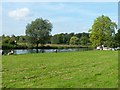
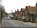
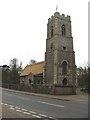
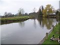
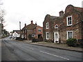
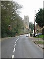
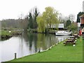

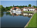
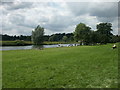
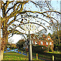
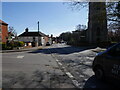
101 photos from this area
Area Information
Key information about the NR12 7DW including its size, population, and administrative classification.
- Area Type
- Postcode
- Area Size
- 1.2 hectares
- Population
- 1605
- Population Density
- 106 people/km²
House Prices in NR12 7DW
22
Properties
£341,655
Average Sold Price
£120,000
Lowest Price
£595,000
Highest Price
Showing 22 properties
| Address | Type | Beds | Baths | Last Sale Price | Last Sale Date | |
|---|---|---|---|---|---|---|
| 43 CHURCH STREET, Coltishall, NR12 7DW | Cottage | 1 | 1 | £215,000 | Jul 2023 | |
| Wayside, 51 Church Street, Coltishall, NR12 7DW | Semi-detached | 2 | 1 | £300,000 | May 2022 | |
| South View, 71 Church Street, Coltishall, NR12 7DW | Detached | 4 | 3 | £515,000 | Mar 2022 | |
| 83 Church Street, Coltishall, NR12 7DW | Bungalow | - | - | £595,000 | Sep 2021 | |
| 95 Church Street, Coltishall, NR12 7DW | house | 5 | 3 | £450,000 | Mar 2021 | |
| Manor Cottage, 67 Church Street, Coltishall, NR12 7DW | Retail | 4 | 2 | £507,000 | Feb 2021 | |
| Risings, 93 Church Street, Coltishall, NR12 7DW | house | 4 | - | £485,000 | Nov 2012 | |
| Corner Cottage, 35 Church Street, Coltishall, NR12 7DW | house | 2 | 2 | £140,000 | Mar 2010 | |
| 45 Church Street, Coltishall, NR12 7DW | Semi-detached | - | - | £182,000 | Aug 2007 | |
| Thurcroft, 79 Church Street, Coltishall, NR12 7DW | Bungalow | - | - | £249,200 | Mar 2003 |
Page 1 of 3
Energy Efficiency in NR12 7DW
Amenities
Schools
| Rank | School | Type | Entry gender | Ages |
|---|
Explore more schools in this area
Go to Schools tabDemographics
Household Size
Two person
most common
Accommodation Type
Houses
most common
Tenure
74
majority
Ethnic Group
White
most common
Religion
N/A
most common
Household Composition
N/A
most common
Age
47
median
Adults (30-64 years)
most common
Household Deprivation
N/A
with no deprivation
NS-SEC
38
in Lower managerial occupations
Explore more demographic insights in this area
Go to Demographics tabPlanning
Planning Constraints
- Flood RiskPremium
- Ramsar Wetland SitesPremium
- Area of Outstanding Natural BeautyPremium
- Protected Nature ReservePremium
- Protected WoodlandPremium