Area Overview for NR12 0AS
Photos of NR12 0AS
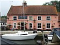
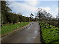
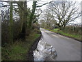
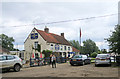
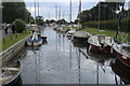
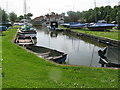
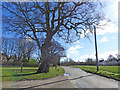
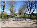
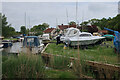
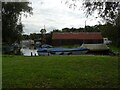
21 photos from this area
Area Information
Key information about the NR12 0AS including its size, population, and administrative classification.
- Area Type
- Postcode
- Area Size
- 38.4 hectares
- Population
- 1356
- Population Density
- 82 people/km²
House Prices in NR12 0AS
17
Properties
£492,714
Average Sold Price
£294,000
Lowest Price
£760,000
Highest Price
Showing 17 properties
| Address | Type | Beds | Baths | Last Sale Price | Last Sale Date | |
|---|---|---|---|---|---|---|
| Nursery Cottage, Sutton Road, Hickling, NR12 0AS | house | - | - | £550,000 | Mar 2023 | |
| Pinecroft, Sutton Road, Hickling, NR12 0AS | house | - | - | £760,000 | Oct 2021 | |
| Mariposas, Sutton Road, Hickling, NR12 0AS | Detached | 3 | 1 | £395,000 | Dec 2019 | |
| Heath Farm, Sutton Road, Hickling, NR12 0AS | Detached | 4 | 2 | £350,000 | Feb 2017 | |
| The Old Manor House, Sutton Road, Hickling, NR12 0AS | Detached | 5 | 2 | £700,000 | Feb 2017 | |
| Cranford Cottage, Sutton Road, Hickling, NR12 0AS | Detached | 3 | - | £294,000 | Jan 2014 | |
| Heath Barn, Sutton Road, Hickling, NR12 0AS | Bungalow | - | - | £400,000 | Apr 2006 | |
| Poplar Farm, Sutton Road, Hickling, NR12 0AS | Bungalow | 4 | - | - | - | |
| Heath Farm Caravan Site, Sutton Road, Hickling, NR12 0AS | commercial | - | - | - | - | |
| Annexe, Willow Trees, Sutton Road, Hickling, NR12 0AS | Bungalow | 2 | - | - | - |
Page 1 of 2
Energy Efficiency in NR12 0AS
Amenities
Schools
| Rank | School | Type | Entry gender | Ages |
|---|
Explore more schools in this area
Go to Schools tabDemographics
Household Size
Two person
most common
Accommodation Type
Houses
most common
Tenure
82
majority
Ethnic Group
White
most common
Religion
N/A
most common
Household Composition
N/A
most common
Age
47
median
Adults (30-64 years)
most common
Household Deprivation
N/A
with no deprivation
NS-SEC
30
in Lower managerial occupations
Explore more demographic insights in this area
Go to Demographics tabPlanning
Planning Constraints
- Flood RiskPremium
- Ramsar Wetland SitesPremium
- Area of Outstanding Natural BeautyPremium
- Protected Nature ReservePremium
- Protected WoodlandPremium