Area Overview for NR10 4DJ
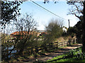
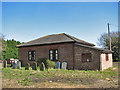
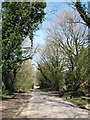
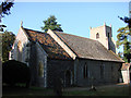
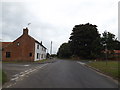
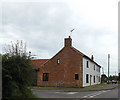
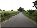
Photos of NR10 4DJ

Area Information
Living in the NR10 4DJ postcode area offers a small, domestic experience within a cluster of just 9,773 square metres. This specific brick-built zone encompasses a resident population of 2,320 people, creating a tight-knit environment where neighbours are often familiar faces. The area acts as a quiet residential hub, distinct from the larger towns that surround it. You can expect a settled atmosphere where daily life revolves around proximity to essential services rather than high-paced urban activity. The modest size of the locality ensures that journeys between home and local amenities remain short, removing the need for lengthy commutes within the immediate neighbourhood. For those seeking a contained living space close to larger transport nodes, this cluster provides a practical base. The demographic profile suggests a mature community, meaning you will likely encounter established residents rather than transient groups. Understanding the scale of this postcode is key; it is not a sprawling district but a focused residential zone. Residents benefit from a compact layout, which simplifies navigation and makes maintenance of the surrounding streets straightforward. The area functions best as a satellite community, leveraging the convenience of nearby larger centres while maintaining its own peaceful character.
- Area Type
- Postcode
- Area Size
- 9773 m²
- Population
- 2320
- Population Density
- 235 people/km²
The housing market in NR10 4DJ is characterised by a dominance of house stock rather than flats or apartments. This accommodation type aligns with the family-centric demographic profile that comprises the majority of the population. With 73% of the population owning their homes, the area is overwhelmingly owner-occupied rather than a rental hub. This high rate of ownership typically indicates a lower turnover of properties compared to areas dominated by landlords or single-occupant rentals. When buying, you will likely access a market where sellers have a longer-term interest in their property and the local street. The presence of houses suggests that personal space and gardens are standard fixtures in the NR10 4DJ landscape. Buyers should expect a traditional English residential setting where bungalows and detached homes prevail. There is little evidence of student housing or transient accommodation, which stabilises the market and makes it more suitable for buyers seeking permanence. The small geographical footprint of the postcode limits the sheer volume of listings, meaning available homes may compete more heavily than in larger districts. If you are looking for a flat in a block of units, this location will not meet those specific criteria. Instead, it offers a classic suburban experience where ownership is the norm.
House Prices in NR10 4DJ
Showing 13 properties
| Address | Type | Beds | Baths | Last Sale Price | Last Sale Date | |
|---|---|---|---|---|---|---|
| 3 Nash Road, Felthorpe, NR10 4DJ | Semi-detached | 3 | 1 | £257,000 | Jul 2025 | |
| 12 Nash Road, Felthorpe, NR10 4DJ | house | - | - | £260,000 | Sep 2024 | |
| 10 Nash Road, Felthorpe, NR10 4DJ | Semi-detached | 2 | 1 | £227,000 | Dec 2018 | |
| 7 Nash Road, Felthorpe, NR10 4DJ | Semi-detached | - | - | £148,000 | Aug 2008 | |
| 3A Nash Road, Felthorpe, NR10 4DJ | Land | - | - | - | - | |
| 1 Nash Road, Felthorpe, NR10 4DJ | house | - | - | - | - | |
| 2 Nash Road, Felthorpe, NR10 4DJ | house | - | - | - | - | |
| 4 Nash Road, Felthorpe, NR10 4DJ | Semi-detached | 3 | - | - | - | |
| 6 Nash Road, Felthorpe, NR10 4DJ | house | - | - | - | - | |
| 8 Nash Road, Felthorpe, NR10 4DJ | house | - | - | - | - |
Energy Efficiency in NR10 4DJ
Living in NR10 4DJ places you within practical reach of several key retail and transport amenities that define daily convenience. You have five major retail outlets nearby, including Lidl Taverham, Tesco Thorpe Mariott, and Tesco Taverham, ensuring you do not need to travel far for groceries or daily essentials. For travel flexibility, Norwich International Airport is just one unit away in the nearby amenities list, allowing for straightforward domestic and international flights. Public transport links are also accessible, with Aylsham metro station located just one metro stop distance from the postcode. This combination of supermarkets and a nearby airport creates a lifestyle that balances suburban quiet with urban accessibility. You can buy fresh breakfasts in the morning and fly out in the afternoon without stress. The presence of these specific brands and transport hubs means the area feels connected despite its small size. Residents benefit from a choice between local small shops in the immediate postcodes and larger supermarkets in nearby centres. Dining options within the immediate cluster are not listed in the data, but retail proximity suggests a focus on practicality over luxury dining. You enjoy the convenience of a self-sufficient community backed by robust national services.
Amenities
Schools
Families residing in NR10 4DJ have access to two primary educational institutions within their immediate vicinity, both catering to the needs of local children. The nearest options are Horsford Church of England Junior School and Horsford CofE VA Primary School. Both of these facilities cater specifically to the primary years of education, suggesting a focus on early learning and foundational skills for young residents. Horsford CofE VA Primary School holds a 'good' Ofsted rating, providing a clear metric of educational quality for parents evaluating the area. The absence of secondary schools in the list indicates that secondary education for local children requires travel further afield to larger towns. This mix means the immediate neighbourhood serves as a feeder for primary education while the secondary phase happens outside the postcode boundary. For families relocating to the area, knowing that award-winning primary schooling is close by is a significant advantage. The presence of Church of England schools highlights the community's ties to traditional religious and educational structures. While you cannot find secondary academies within the NR10 4DJ data, the nearby primary schools demonstrate a reliable start to the educational journey for your children.
| Rank | School | Type | Entry gender | Ages |
|---|
Explore more schools in this area
Go to Schools tabDemographics
The community in NR10 4DJ is defined by a mature population with a median age of 47 years. Most residents fall into the adult age range of 30 to 64 years, indicating a neighbourhood perhaps made up of families and professionals further along in their careers. You will find that 73% of households own their properties outright or through a mortgage, a figure that significantly exceeds the national rental market average and suggests high stability. The primary form of accommodation comprises houses, reinforcing the family-oriented nature of the settlement. These figures point to a settled environment where long-term residents value security and permanence. The predominant ethnic group is White, reflecting the historical settlement patterns of this specific region in Norfolk. With no significant high-density developments or student housing projects mentioned in the local data, the social fabric remains consistent and traditional. This demographic makeup creates a quiet atmosphere, suitable for those seeking a quiet retirement or a stable family home away from the instability of transient markets. The high ownership rate also implies stronger local governance, as owners often engage more actively in community matters. You are entering an area where the people have put down roots and are unlikely to move frequently.
Household Size
Accommodation Type
Tenure
Ethnic Group
Religion
Household Composition
Age
Household Deprivation
NS-SEC
Explore more demographic insights in this area
Go to Demographics tabPlanning
Planning Constraints
- Flood RiskPremium
- Ramsar Wetland SitesPremium
- Area of Outstanding Natural BeautyPremium
- Protected Nature ReservePremium
- Protected WoodlandPremium