Area Overview for NR10 4AH
Photos of NR10 4AH

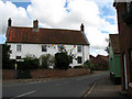


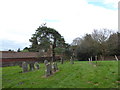
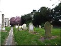
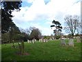
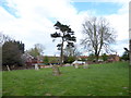

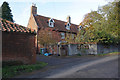
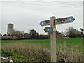
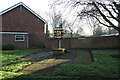
83 photos from this area
Area Information
Key information about the NR10 4AH including its size, population, and administrative classification.
- Area Type
- Postcode
- Area Size
- 1.4 km²
- Population
- 1827
- Population Density
- 55 people/km²
House Prices in NR10 4AH
16
Properties
£186,350
Average Sold Price
£85,100
Lowest Price
£322,500
Highest Price
Showing 16 properties
| Address | Type | Beds | Baths | Last Sale Price | Last Sale Date | |
|---|---|---|---|---|---|---|
| Penncroft, 16 Booton Road, Cawston, NR10 4AH | Bungalow | 3 | 1 | £250,000 | May 2025 | |
| 17 Booton Road, Cawston, NR10 4AH | Bungalow | - | - | £322,500 | Apr 2024 | |
| Goosepie Cottage, 9 Booton Road, Cawston, NR10 4AH | house | 2 | - | £139,500 | Oct 2011 | |
| Willow Tree Cottage, 15 Booton Road, Cawston, NR10 4AH | Semi-detached | - | - | £197,000 | Mar 2004 | |
| Saint Agnes Cottage, 11 Booton Road, Cawston, NR10 4AH | Semi-detached | 2 | - | £124,000 | Apr 2002 | |
| The Homestead, 14 Booton Road, Cawston, NR10 4AH | Bungalow | - | - | £85,100 | May 2000 | |
| Cranberry Cottage, 7 Booton Road, Cawston, NR10 4AH | house | 2 | 1 | - | - | |
| Old Forge, Goosepie Lane, Booton Road, Cawston, NR10 4AH | Detached | 2 | 1 | - | - | |
| Holly Tree Farm, Valley Farm, Booton Road, Cawston, NR10 4AH | Bungalow | - | - | - | - | |
| Valley Farm Bungalow, Booton Road, Cawston, NR10 4AH | Detached | - | - | - | - |
Page 1 of 2
Energy Efficiency in NR10 4AH
Amenities
Schools
| Rank | School | Type | Entry gender | Ages |
|---|
Explore more schools in this area
Go to Schools tabDemographics
Household Size
Two person
most common
Accommodation Type
Houses
most common
Tenure
65
majority
Ethnic Group
White
most common
Religion
N/A
most common
Household Composition
N/A
most common
Age
47
median
Adults (30-64 years)
most common
Household Deprivation
N/A
with no deprivation
NS-SEC
29
in Lower managerial occupations
Explore more demographic insights in this area
Go to Demographics tabPlanning
Planning Constraints
- Flood RiskPremium
- Ramsar Wetland SitesPremium
- Area of Outstanding Natural BeautyPremium
- Protected Nature ReservePremium
- Protected WoodlandPremium