Area Overview for NR10 3FY
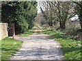
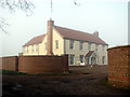
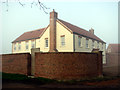
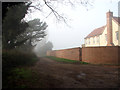
Photos of NR10 3FY


Area Information
Living in NR10 3FY means residing within a highly specific residential cluster defined by the postcode NR10 3FY. This location covers exactly 1.1 hectares and serves a population of 2320 people. The area is characterised by a tightly knit community with a population density of 235 people per square kilometre. You will find yourself in a setting where every house is part of a manageable and close-knit neighbourhood. The scale of the area ensures a quiet, residential atmosphere rather than the noise of a commercial centre. Homes in NR10 3FY are situated in a defined postcode area that functions primarily as a sleeping location for those working in surrounding towns such as Norwich. Daily life here revolves around local streets and nearby amenities rather than internal district centres. The compact nature of the 1.1 hectare site means distances between properties are short. You experience a neighbourhood where familiarity with your immediate surroundings is high. This postcode represents a slice of life where community interaction is easier due to the physical closeness of residents. The area is established and consistent, offering a traditional suburban living experience. Prospective buyers here know they are entering a zone with clear boundaries and a focused residential purpose. The small size of the area creates a distinct sense of place without the sprawl of larger outlying districts.
- Area Type
- Postcode
- Area Size
- 1.1 hectares
- Population
- 2320
- Population Density
- 235 people/km²
The property market in NR10 3FY is distinctly characterised by domestic ownership. Eighty-six broad out of the hundred residents do not rent; specifically, 73% of the local population are homeowners. This high percentage signals that the area is driven by owner-occupiers rather than landlords or short-term tenants. The predominant accommodation type found here is houses. You will find few, if any, flats or apartments within this specific postcode. Houses in NR10 3FY are the primary asset for the majority of residents. This stock appeals to those seeking detached or semi-detached living environments with private outdoor space. The lack of flat listings or rental data implies a market where people buy to stay. Prospective buyers looking at this postcode are entering a sellers' market for family homes. The 1.1 hectare size of the area limits the total volume of inventory available, meaning choices are scarce but carefully selected. Owner occupancy at this level reduces the complexity of tenancy agreements and tenant turnover. When you view homes in NR10 3FY, you are viewing properties designed for long-term living. The market reflects a desire for stability and space. There is a clear preference for traditional housing over modern build apartments or shared ownership schemes. This consistency in property type ensures uniformity across the cluster of streets that make up the neighbourhood.
House Prices in NR10 3FY
Showing 7 properties
| Address | Type | Beds | Baths | Last Sale Price | Last Sale Date | |
|---|---|---|---|---|---|---|
| 3 Blythe Way, Horsford, NR10 3FY | house | 4 | 3 | £405,000 | Aug 2025 | |
| 4 Blythe Way, Horsford, NR10 3FY | house | - | - | £500,000 | Feb 2022 | |
| 1 Blythe Way, Horsford, NR10 3FY | Detached | 4 | 3 | £337,000 | Jun 2018 | |
| 2 Blythe Way, Horsford, NR10 3FY | house | - | - | £328,995 | Nov 2015 | |
| 6 Blythe Way, Horsford, NR10 3FY | house | 4 | 3 | £259,995 | Jun 2015 | |
| 7 Blythe Way, Horsford, NR10 3FY | house | - | - | £330,995 | Jun 2015 | |
| 5 Blythe Way, Horsford, NR10 3FY | house | - | - | £365,995 | Jun 2015 |
Energy Efficiency in NR10 3FY
Your daily life in NR10 3FY benefits from a practical array of nearby amenities within easy reach. You have access to five key retail locations, including East of England Co-operative Co, Tesco Thorpe Mariott, and Tesco Drayton. These venues provide comprehensive shopping options in your immediate surroundings. For travel and leisure, Norwich International Airport is one practical amenity within reach. This allows you to schedule trips or receive guests with ease. Aylsham serves as your nearest metro station, connecting you to wider rail networks. Norwich Railway Station is your primary rail hub. These transport links ensure you can commute to Norwich or beyond without relying solely on local buses. The availability of major supermarkets like Tesco means you stock your pantry without venturing into a city centre. You can pick up groceries, fresh produce, and daily essentials close to your home. The presence of these specific venues reduces the time needed for errands. Your lifestyle is supported by convenient access to both high street shopping and transport hubs. The area balances residential quiet with the necessity of nearby services. You enjoy the convenience of large retailers while living in a smaller, quieter cluster.
Amenities
Schools
Families in NR10 3FY have access to two primary educational institutions. The nearest options are Horsford CofE VA Primary School and Horsford Church of England Junior School. Both schools provide primary level education for your children. Horsford CofE VA Primary School holds a good Ofsted rating, which confirms its quality and adherence to national standards. The presence of both a VA primary and a CofE junior school indicates a strong local community support for religious and faith-based education. You can expect a school environment that aligns with traditional values and structured learning. The proximity of these schools suggests that local residents prioritise having their children educated within the immediate vicinity. This arrangement reduces daily travel time for young students. When considering schools near NR10 3FY, you find a focused selection rather than a wide mix of secondary options. The area serves as a feeder zone for these primary institutions. Parents living here will be well supported by the infrastructure dedicated to younger students. The good rating of one of the schools provides a solid foundation for early education. You do not have to look far beyond your doorstep to secure schooling for your family.
| Rank | School | Type | Entry gender | Ages |
|---|
Explore more schools in this area
Go to Schools tabDemographics
The community within NR10 3FY is defined by a stable and mature demographic profile. The median age of residents is 47 years old. Most people living here fall into the adult category, specifically those between 30 and 64 years of age. This age range suggests a neighbourhood dominated by families and professionals in the middle stages of their careers. Home ownership levels are exceptionally high, with 73% of residents owning their property outright or with a mortgage. This figure indicates that NR10 3FY is not a transient rental area but a place where people put down roots. The predominant accommodation type consists of houses, offering plenty of space for families or those who desire a separate garden. The predominant ethnic group in the area is White, reflecting the traditional demographic makeup of the region. You will find a community built on long-term residency rather than short-term tenancies. The low population density of 235 people per square kilometre supports this family-oriented environment. Residents here are likely to have lived in the same neighbourhood for many years. The concentration of adults and homeowners creates a stable social fabric. There are no young families or single students dominating the streets. Instead, you find a balanced community of partners, parents, and retired individuals sharing the space. The high home ownership rate reinforces the idea of a secure and established local population.
Household Size
Accommodation Type
Tenure
Ethnic Group
Religion
Household Composition
Age
Household Deprivation
NS-SEC
Explore more demographic insights in this area
Go to Demographics tabPlanning
Planning Constraints
- Flood RiskPremium
- Ramsar Wetland SitesPremium
- Area of Outstanding Natural BeautyPremium
- Protected Nature ReservePremium
- Protected WoodlandPremium