Area Overview for NR10 3FQ
Photos of NR10 3FQ
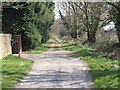
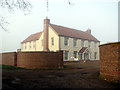
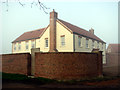


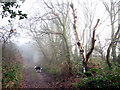

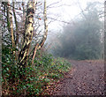
29 photos from this area
Area Information
Key information about the NR10 3FQ including its size, population, and administrative classification.
- Area Type
- Postcode
- Area Size
- 3.2 hectares
- Population
- 2320
- Population Density
- 235 people/km²
House Prices in NR10 3FQ
24
Properties
£216,000
Average Sold Price
£100,000
Lowest Price
£390,000
Highest Price
Showing 24 properties
| Address | Type | Beds | Baths | Last Sale Price | Last Sale Date | |
|---|---|---|---|---|---|---|
| 1 Thomas Way, Horsford, NR10 3FQ | Detached | 4 | 3 | £390,000 | Jun 2025 | |
| 24 Thomas Way, Horsford, NR10 3FQ | Semi-detached | 3 | 2 | £265,000 | Oct 2022 | |
| 23 Thomas Way, Horsford, NR10 3FQ | house | 3 | 2 | £270,000 | Aug 2022 | |
| 20 Thomas Way, Horsford, NR10 3FQ | house | - | - | £100,000 | Jun 2020 | |
| 3 Thomas Way, Horsford, NR10 3FQ | Semi-detached | 2 | 1 | £183,000 | Nov 2019 | |
| 17 Thomas Way, Horsford, NR10 3FQ | Semi-detached | 3 | 2 | £118,000 | Apr 2019 | |
| 2 Thomas Way, Horsford, NR10 3FQ | house | 2 | 1 | £186,000 | Dec 2017 | |
| 9 Thomas Way, Horsford, NR10 3FQ | Flat | - | - | - | - | |
| 14 Thomas Way, Horsford, NR10 3FQ | house | - | - | - | - | |
| 22 Thomas Way, Horsford, NR10 3FQ | house | - | - | - | - |
Page 1 of 3
Energy Efficiency in NR10 3FQ
Amenities
Schools
| Rank | School | Type | Entry gender | Ages |
|---|
Explore more schools in this area
Go to Schools tabDemographics
Household Size
Two person
most common
Accommodation Type
Houses
most common
Tenure
73
majority
Ethnic Group
White
most common
Religion
N/A
most common
Household Composition
N/A
most common
Age
47
median
Adults (30-64 years)
most common
Household Deprivation
N/A
with no deprivation
NS-SEC
31
in Lower managerial occupations
Explore more demographic insights in this area
Go to Demographics tabPlanning
Planning Constraints
- Flood RiskPremium
- Ramsar Wetland SitesPremium
- Area of Outstanding Natural BeautyPremium
- Protected Nature ReservePremium
- Protected WoodlandPremium