Area Overview for NR10 3AD
Photos of NR10 3AD
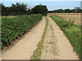

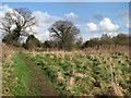
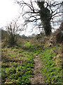
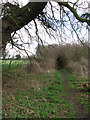
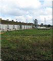
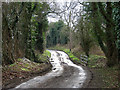
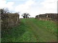
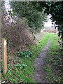
24 photos from this area
Area Information
Key information about the NR10 3AD including its size, population, and administrative classification.
- Area Type
- Postcode
- Area Size
- 39.9 hectares
- Population
- 1792
- Population Density
- 245 people/km²
House Prices in NR10 3AD
93
Properties
£236,768
Average Sold Price
£45,000
Lowest Price
£450,000
Highest Price
Showing 93 properties
| Address | Type | Beds | Baths | Last Sale Price | Last Sale Date | |
|---|---|---|---|---|---|---|
| The Oaks, 71 Newton Street, Newton St Faith, NR10 3AD | Semi-detached | 3 | 1 | £292,000 | Jan 2025 | |
| Acres, 19 Newton Street, Newton St Faith, NR10 3AD | Bungalow | 3 | 1 | £330,000 | Dec 2024 | |
| Oaklea, 74 Newton Street, Newton St Faith, NR10 3AD | Bungalow | 3 | 1 | £315,000 | Nov 2024 | |
| 73 Newton Street, Newton St Faith, NR10 3AD | Semi-detached | 4 | 2 | £265,000 | Nov 2024 | |
| 8 Newton Street, Newton St Faith, NR10 3AD | Cottage | 3 | 1 | £294,000 | May 2024 | |
| Mountain Ash, 72 Newton Street, Newton St Faith, NR10 3AD | Bungalow | - | - | £165,000 | Jan 2024 | |
| Rye House, 57 Newton Street, Newton St Faith, NR10 3AD | Detached | 3 | 1 | £345,000 | Sep 2023 | |
| Catriona, 22 Newton Street, Newton St Faith, NR10 3AD | Bungalow | - | - | £350,000 | Dec 2022 | |
| 14 Newton Street, Newton St Faith, NR10 3AD | Retail | 2 | 1 | £220,000 | Feb 2022 | |
| 30 Newton Street, Newton St Faith, NR10 3AD | Bungalow | - | - | £222,500 | Jun 2021 |
Page 1 of 10
Energy Efficiency in NR10 3AD
Amenities
Schools
| Rank | School | Type | Entry gender | Ages |
|---|
Explore more schools in this area
Go to Schools tabDemographics
Household Size
Two person
most common
Accommodation Type
Houses
most common
Tenure
72
majority
Ethnic Group
White
most common
Religion
N/A
most common
Household Composition
N/A
most common
Age
47
median
Adults (30-64 years)
most common
Household Deprivation
N/A
with no deprivation
NS-SEC
30
in Lower managerial occupations
Explore more demographic insights in this area
Go to Demographics tabPlanning
Planning Constraints
- Flood RiskPremium
- Ramsar Wetland SitesPremium
- Area of Outstanding Natural BeautyPremium
- Protected Nature ReservePremium
- Protected WoodlandPremium