Area Overview for NR1 1JF
Photos of NR1 1JF

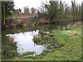
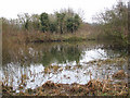
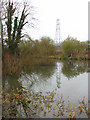
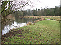
100 photos from this area
Area Information
Key information about the NR1 1JF including its size, population, and administrative classification.
- Area Type
- Postcode
- Area Size
- 8036 m²
- Population
- 1217
- Population Density
- 2914 people/km²
House Prices in NR1 1JF
15
Properties
£225,357
Average Sold Price
£153,000
Lowest Price
£284,000
Highest Price
Showing 15 properties
| Address | Type | Beds | Baths | Last Sale Price | Last Sale Date | |
|---|---|---|---|---|---|---|
| 14, Clarence Harbour Court, Carrow Road, Norwich, NR1 1JF | house | 3 | 2 | £284,000 | Jan 2023 | |
| 13, Clarence Harbour Court, Carrow Road, Norwich, NR1 1JF | Semi-detached | 4 | 2 | £270,000 | Sep 2022 | |
| 7, Clarence Harbour Court, Carrow Road, Norwich, NR1 1JF | Terraced | 3 | 1 | £255,000 | Jan 2022 | |
| 6, Clarence Harbour Court, Carrow Road, Norwich, NR1 1JF | Terraced | 3 | 2 | £228,000 | Oct 2019 | |
| 1, Clarence Harbour Court, Carrow Road, Norwich, NR1 1JF | Terraced | 3 | 3 | £230,000 | Sep 2019 | |
| 5, Clarence Harbour Court, Carrow Road, Norwich, NR1 1JF | Terraced | 3 | 2 | £230,000 | Jun 2019 | |
| 2, Clarence Harbour Court, Carrow Road, Norwich, NR1 1JF | Terraced | 3 | - | £225,000 | Dec 2018 | |
| 4, Clarence Harbour Court, Carrow Road, Norwich, NR1 1JF | Maisonette | 3 | 1 | £164,000 | Oct 2018 | |
| 3, Clarence Harbour Court, Carrow Road, Norwich, NR1 1JF | house | 3 | 1 | £215,000 | Mar 2018 | |
| 12, Clarence Harbour Court, Carrow Road, Norwich, NR1 1JF | Terraced | 3 | 1 | £238,000 | Jul 2017 |
Page 1 of 2
Energy Efficiency in NR1 1JF
Amenities
Schools
| Rank | School | Type | Entry gender | Ages |
|---|
Explore more schools in this area
Go to Schools tabDemographics
Household Size
One person
most common
Accommodation Type
Flats
most common
Tenure
35
majority
Ethnic Group
White
most common
Religion
N/A
most common
Household Composition
N/A
most common
Age
47
median
Adults (30-64 years)
most common
Household Deprivation
N/A
with no deprivation
NS-SEC
38
in Lower managerial occupations
Explore more demographic insights in this area
Go to Demographics tabPlanning
Planning Constraints
- Flood RiskPremium
- Ramsar Wetland SitesPremium
- Area of Outstanding Natural BeautyPremium
- Protected Nature ReservePremium
- Protected WoodlandPremium