Area Overview for NR1 1HS
Photos of NR1 1HS

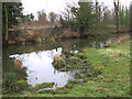
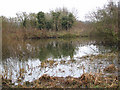
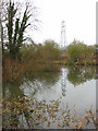
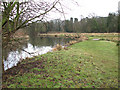
100 photos from this area
Area Information
Key information about the NR1 1HS including its size, population, and administrative classification.
- Area Type
- Postcode
- Area Size
- 5883 m²
- Population
- 1217
- Population Density
- 2914 people/km²
House Prices in NR1 1HS
25
Properties
£207,233
Average Sold Price
£51,500
Lowest Price
£315,000
Highest Price
Showing 25 properties
| Address | Type | Beds | Baths | Last Sale Price | Last Sale Date | |
|---|---|---|---|---|---|---|
| 35 Carrow Road, Norwich, NR1 1HS | Terraced | 4 | 1 | £280,000 | Oct 2025 | |
| 77 Carrow Road, Norwich, NR1 1HS | Terraced | 3 | 1 | £305,000 | Jul 2024 | |
| 43 Carrow Road, Norwich, NR1 1HS | Terraced | 3 | 1 | £228,000 | Dec 2023 | |
| 37 Carrow Road, Norwich, NR1 1HS | Terraced | 3 | 1 | £235,000 | Oct 2023 | |
| 71 Carrow Road, Norwich, NR1 1HS | Terraced | 3 | 2 | £285,000 | Oct 2023 | |
| 47 Carrow Road, Norwich, NR1 1HS | house | 3 | - | £261,450 | Nov 2022 | |
| 45 Carrow Road, Norwich, NR1 1HS | Terraced | 3 | 1 | £280,000 | Sep 2022 | |
| 79 Carrow Road, Norwich, NR1 1HS | Terraced | 3 | 2 | £315,000 | Jul 2022 | |
| 49 Carrow Road, Norwich, NR1 1HS | Terraced | 2 | 1 | £234,000 | Apr 2022 | |
| 69 Carrow Road, Norwich, NR1 1HS | Terraced | 2 | 1 | £232,500 | Jul 2021 |
Page 1 of 3
Energy Efficiency in NR1 1HS
Amenities
Schools
| Rank | School | Type | Entry gender | Ages |
|---|
Explore more schools in this area
Go to Schools tabDemographics
Household Size
One person
most common
Accommodation Type
Flats
most common
Tenure
35
majority
Ethnic Group
White
most common
Religion
N/A
most common
Household Composition
N/A
most common
Age
47
median
Adults (30-64 years)
most common
Household Deprivation
N/A
with no deprivation
NS-SEC
38
in Lower managerial occupations
Explore more demographic insights in this area
Go to Demographics tabPlanning
Planning Constraints
- Flood RiskPremium
- Ramsar Wetland SitesPremium
- Area of Outstanding Natural BeautyPremium
- Protected Nature ReservePremium
- Protected WoodlandPremium