Area Overview for MK43 9EX
Photos of MK43 9EX
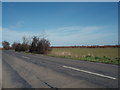
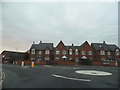
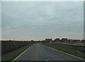
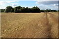
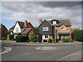
8 photos from this area
Area Information
Key information about the MK43 9EX including its size, population, and administrative classification.
- Area Type
- Postcode
- Area Size
- 1.2 hectares
- Population
- 1980
- Population Density
- 4374 people/km²
House Prices in MK43 9EX
26
Properties
£257,397
Average Sold Price
£72,500
Lowest Price
£555,000
Highest Price
Showing 26 properties
| Address | Type | Beds | Baths | Last Sale Price | Last Sale Date | |
|---|---|---|---|---|---|---|
| 11 Russell Way, Wootton, MK43 9EX | Detached | 2 | 1 | £340,000 | Oct 2025 | |
| 17 Russell Way, Wootton, MK43 9EX | Bungalow | 2 | 1 | £365,000 | Sep 2025 | |
| 15 Russell Way, Wootton, MK43 9EX | Bungalow | 3 | 1 | £375,000 | Sep 2023 | |
| 19 Russell Way, Wootton, MK43 9EX | Bungalow | - | - | £355,000 | Apr 2023 | |
| 9 Russell Way, Wootton, MK43 9EX | Detached | 4 | 2 | £555,000 | Jun 2021 | |
| 27 Russell Way, Wootton, MK43 9EX | Semi-detached | 2 | - | £230,050 | Nov 2019 | |
| 14 Russell Way, Wootton, MK43 9EX | Bungalow | - | - | £270,000 | Apr 2019 | |
| 21 Russell Way, Wootton, MK43 9EX | Bungalow | - | - | £235,000 | Jun 2016 | |
| 25 Russell Way, Wootton, MK43 9EX | Bungalow | 2 | - | £180,000 | Apr 2014 | |
| 24 Russell Way, Wootton, MK43 9EX | Bungalow | - | - | £195,000 | Oct 2010 |
Page 1 of 3
Energy Efficiency in MK43 9EX
Amenities
Schools
| Rank | School | Type | Entry gender | Ages |
|---|
Explore more schools in this area
Go to Schools tabDemographics
Household Size
Family (3-5 people)
most common
Accommodation Type
Houses
most common
Tenure
70
majority
Ethnic Group
White
most common
Religion
N/A
most common
Household Composition
N/A
most common
Age
47
median
Adults (30-64 years)
most common
Household Deprivation
N/A
with no deprivation
NS-SEC
37
in Lower managerial occupations
Explore more demographic insights in this area
Go to Demographics tabPlanning
Planning Constraints
- Flood RiskPremium
- Ramsar Wetland SitesPremium
- Area of Outstanding Natural BeautyPremium
- Protected Nature ReservePremium
- Protected WoodlandPremium