Area Overview for MK43 9HF
Photos of MK43 9HF
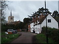
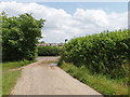
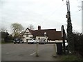
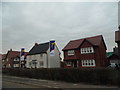

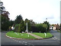
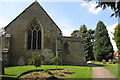
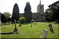
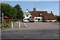
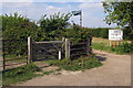
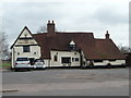
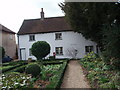
14 photos from this area
Area Information
Key information about the MK43 9HF including its size, population, and administrative classification.
- Area Type
- Postcode
- Area Size
- 7.2 hectares
- Population
- 1882
- Population Density
- 251 people/km²
House Prices in MK43 9HF
26
Properties
£349,542
Average Sold Price
£115,000
Lowest Price
£750,000
Highest Price
Showing 26 properties
| Address | Type | Beds | Baths | Last Sale Price | Last Sale Date | |
|---|---|---|---|---|---|---|
| Barlow, 52C Church Road, Wootton, MK43 9HF | Detached | 5 | 2 | £600,000 | Jul 2025 | |
| 2, The Old Barn, Church Road, Wootton, MK43 9HF | Semi-detached | 5 | 3 | £750,000 | Mar 2025 | |
| 1, The Old Barn, Church Road, Wootton, MK43 9HF | Semi-detached | 5 | 3 | £725,000 | Mar 2021 | |
| 26 Church Road, Wootton, MK43 9HF | house | 3 | - | £295,000 | Sep 2018 | |
| 36 Church Road, Wootton, MK43 9HF | Semi-detached | 3 | - | £285,000 | Aug 2015 | |
| 30 Church Road, Wootton, MK43 9HF | house | - | - | £205,000 | Jan 2012 | |
| 48 Church Road, Wootton, MK43 9HF | house | - | - | £347,500 | Sep 2010 | |
| 50A Church Road, Wootton, MK43 9HF | house | - | - | £230,000 | Oct 2009 | |
| 52A Church Road, Wootton, MK43 9HF | Semi-detached | - | - | £292,000 | Aug 2004 | |
| 28 Church Road, Wootton, MK43 9HF | Semi-detached | - | - | £145,000 | Nov 2002 |
Page 1 of 3
Energy Efficiency in MK43 9HF
Amenities
Schools
| Rank | School | Type | Entry gender | Ages |
|---|
Explore more schools in this area
Go to Schools tabDemographics
Household Size
Family (3-5 people)
most common
Accommodation Type
Houses
most common
Tenure
79
majority
Ethnic Group
White
most common
Religion
N/A
most common
Household Composition
N/A
most common
Age
47
median
Adults (30-64 years)
most common
Household Deprivation
N/A
with no deprivation
NS-SEC
44
in Lower managerial occupations
Explore more demographic insights in this area
Go to Demographics tabPlanning
Planning Constraints
- Flood RiskPremium
- Ramsar Wetland SitesPremium
- Area of Outstanding Natural BeautyPremium
- Protected Nature ReservePremium
- Protected WoodlandPremium