Area Overview for MK43 0UH
Photos of MK43 0UH
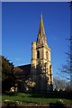
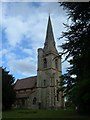

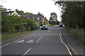

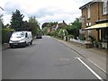
30 photos from this area
Area Information
Key information about the MK43 0UH including its size, population, and administrative classification.
- Area Type
- Postcode
- Area Size
- 1.7 hectares
- Population
- 1417
- Population Density
- 36 people/km²
House Prices in MK43 0UH
13
Properties
£288,114
Average Sold Price
£50,000
Lowest Price
£728,000
Highest Price
Showing 13 properties
| Address | Type | Beds | Baths | Last Sale Price | Last Sale Date | |
|---|---|---|---|---|---|---|
| 32 Station Road, Ridgmont, MK43 0UH | Detached | 2 | 1 | £485,000 | May 2022 | |
| 62 Station Road, Ridgmont, MK43 0UH | Semi-detached | 3 | 1 | £407,000 | Aug 2021 | |
| Woodcote Cottage, 30 Station Road, Ridgmont, MK43 0UH | Detached | 2 | 1 | £260,000 | Mar 2020 | |
| Castle Views, 28 Station Road, Ridgmont, MK43 0UH | house | - | - | £728,000 | Feb 2020 | |
| 60 Station Road, Ridgmont, MK43 0UH | house | - | - | £255,000 | Dec 2019 | |
| 56 Station Road, Ridgmont, MK43 0UH | Cottage | 2 | 2 | £292,500 | Nov 2018 | |
| 36 Station Road, Ridgmont, MK43 0UH | Semi-detached | - | - | £224,000 | Nov 2001 | |
| 50 Station Road, Ridgmont, MK43 0UH | Detached | - | - | £190,000 | Jun 2001 | |
| Rose Cottage, 46 Station Road, Ridgmont, MK43 0UH | Detached | - | - | £222,500 | Feb 2001 | |
| Hillside Barn, 56A Station Road, Ridgmont, MK43 0UH | Bungalow | 2 | 1 | £55,250 | Jun 1996 |
Page 1 of 2
Energy Efficiency in MK43 0UH
Amenities
Schools
| Rank | School | Type | Entry gender | Ages |
|---|
Explore more schools in this area
Go to Schools tabDemographics
Household Size
Two person
most common
Accommodation Type
Houses
most common
Tenure
55
majority
Ethnic Group
White
most common
Religion
N/A
most common
Household Composition
N/A
most common
Age
47
median
Adults (30-64 years)
most common
Household Deprivation
N/A
with no deprivation
NS-SEC
44
in Lower managerial occupations
Explore more demographic insights in this area
Go to Demographics tabPlanning
Planning Constraints
- Flood RiskPremium
- Ramsar Wetland SitesPremium
- Area of Outstanding Natural BeautyPremium
- Protected Nature ReservePremium
- Protected WoodlandPremium