Area Overview for MK43 0LU
Photos of MK43 0LU
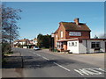
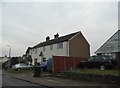
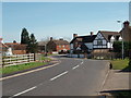
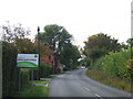
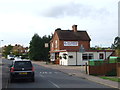
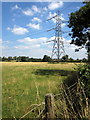
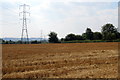
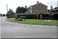
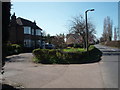
10 photos from this area
Area Information
Key information about the MK43 0LU including its size, population, and administrative classification.
- Area Type
- Postcode
- Area Size
- 15.5 hectares
- Population
- 1882
- Population Density
- 251 people/km²
House Prices in MK43 0LU
18
Properties
£317,227
Average Sold Price
£125,000
Lowest Price
£620,000
Highest Price
Showing 18 properties
| Address | Type | Beds | Baths | Last Sale Price | Last Sale Date | |
|---|---|---|---|---|---|---|
| 55 Upper Shelton Road, Marston Moreteyne, MK43 0LU | Semi-detached | 3 | 2 | £315,500 | Jun 2024 | |
| 73 Upper Shelton Road, Marston Moreteyne, MK43 0LU | house | - | - | £550,000 | Sep 2022 | |
| Shelton House, 57 Upper Shelton Road, Marston Moreteyne, MK43 0LU | Detached | 4 | - | £620,000 | May 2021 | |
| 48 Upper Shelton Road, Marston Moreteyne, MK43 0LU | Detached | - | - | £330,000 | Aug 2017 | |
| 65 Upper Shelton Road, Marston Moreteyne, MK43 0LU | house | - | - | £360,000 | Dec 2016 | |
| 71A Upper Shelton Road, Marston Moreteyne, MK43 0LU | Bungalow | 2 | 1 | £242,000 | Dec 2014 | |
| 71 Upper Shelton Road, Marston Moreteyne, MK43 0LU | Land | 2 | - | £125,000 | Jul 2011 | |
| 69 Upper Shelton Road, Marston Moreteyne, MK43 0LU | Detached | - | - | £312,000 | Jan 2007 | |
| 63 Upper Shelton Road, Marston Moreteyne, MK43 0LU | Detached | - | - | £222,000 | Feb 2006 | |
| 67 Upper Shelton Road, Marston Moreteyne, MK43 0LU | house | - | - | £235,000 | Jun 2005 |
Page 1 of 2
Energy Efficiency in MK43 0LU
Amenities
Schools
| Rank | School | Type | Entry gender | Ages |
|---|
Explore more schools in this area
Go to Schools tabDemographics
Household Size
Family (3-5 people)
most common
Accommodation Type
Houses
most common
Tenure
79
majority
Ethnic Group
White
most common
Religion
N/A
most common
Household Composition
N/A
most common
Age
47
median
Adults (30-64 years)
most common
Household Deprivation
N/A
with no deprivation
NS-SEC
44
in Lower managerial occupations
Explore more demographic insights in this area
Go to Demographics tabPlanning
Planning Constraints
- Flood RiskPremium
- Ramsar Wetland SitesPremium
- Area of Outstanding Natural BeautyPremium
- Protected Nature ReservePremium
- Protected WoodlandPremium