Area Overview for MK43 0LS
Photos of MK43 0LS
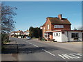
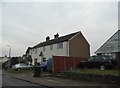
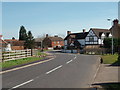
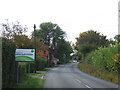
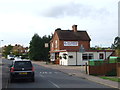
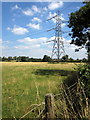
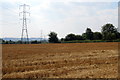
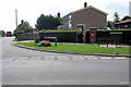
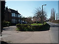
10 photos from this area
Area Information
Key information about the MK43 0LS including its size, population, and administrative classification.
- Area Type
- Postcode
- Area Size
- 20.0 hectares
- Population
- 1304
- Population Density
- 133 people/km²
House Prices in MK43 0LS
26
Properties
£342,658
Average Sold Price
£31,740
Lowest Price
£730,000
Highest Price
Showing 26 properties
| Address | Type | Beds | Baths | Last Sale Price | Last Sale Date | |
|---|---|---|---|---|---|---|
| Malika, 172B Lower Shelton Road, Marston Moreteyne, MK43 0LS | Detached | 3 | 1 | £456,000 | Jul 2023 | |
| 158 Lower Shelton Road, Marston Moreteyne, MK43 0LS | Bungalow | 4 | 2 | £730,000 | Jan 2023 | |
| 176 Lower Shelton Road, Marston Moreteyne, MK43 0LS | Detached | 4 | 4 | £650,000 | Nov 2022 | |
| 174 Lower Shelton Road, Marston Moreteyne, MK43 0LS | Detached | 3 | - | £487,000 | Nov 2020 | |
| 251 Lower Shelton Road, Marston Moreteyne, MK43 0LS | Detached | 3 | 1 | £352,000 | Oct 2020 | |
| 172 Lower Shelton Road, Marston Moreteyne, MK43 0LS | Semi-detached | 4 | 4 | £297,500 | Jul 2020 | |
| 164 Lower Shelton Road, Marston Moreteyne, MK43 0LS | Detached | 4 | - | £355,000 | Jun 2014 | |
| 144 Lower Shelton Road, Marston Moreteyne, MK43 0LS | Semi-detached | 3 | - | £210,000 | Jun 2013 | |
| 140 Lower Shelton Road, Marston Moreteyne, MK43 0LS | Detached | 4 | - | £31,740 | Jul 1999 | |
| 162 Lower Shelton Road, Marston Moreteyne, MK43 0LS | house | - | - | £120,000 | Sep 1997 |
Page 1 of 3
Energy Efficiency in MK43 0LS
Amenities
Schools
| Rank | School | Type | Entry gender | Ages |
|---|
Explore more schools in this area
Go to Schools tabDemographics
Household Size
Family (3-5 people)
most common
Accommodation Type
Houses
most common
Tenure
81
majority
Ethnic Group
White
most common
Religion
N/A
most common
Household Composition
N/A
most common
Age
47
median
Adults (30-64 years)
most common
Household Deprivation
N/A
with no deprivation
NS-SEC
43
in Lower managerial occupations
Explore more demographic insights in this area
Go to Demographics tabPlanning
Planning Constraints
- Flood RiskPremium
- Ramsar Wetland SitesPremium
- Area of Outstanding Natural BeautyPremium
- Protected Nature ReservePremium
- Protected WoodlandPremium