Area Overview for MK43 0BW
Photos of MK43 0BW
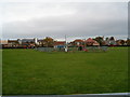
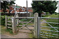
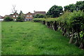
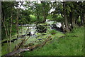
8 photos from this area
Area Information
Key information about the MK43 0BW including its size, population, and administrative classification.
- Area Type
- Postcode
- Area Size
- 2965 m²
- Population
- 1476
- Population Density
- 1211 people/km²
House Prices in MK43 0BW
8
Properties
£186,125
Average Sold Price
£53,500
Lowest Price
£365,000
Highest Price
Showing 8 properties
| Address | Type | Beds | Baths | Last Sale Price | Last Sale Date | |
|---|---|---|---|---|---|---|
| 6 Little Spinney, Cranfield, MK43 0BW | house | - | - | £365,000 | Jul 2022 | |
| 1 Little Spinney, Cranfield, MK43 0BW | Semi-detached | 3 | 2 | £284,000 | Jun 2021 | |
| 7 Little Spinney, Cranfield, MK43 0BW | house | 3 | - | £189,000 | Nov 2014 | |
| 4 Little Spinney, Cranfield, MK43 0BW | Semi-detached | 4 | 1 | £192,500 | Nov 2007 | |
| 8 Little Spinney, Cranfield, MK43 0BW | Semi-detached | - | - | £175,000 | Mar 2004 | |
| 5 Little Spinney, Cranfield, MK43 0BW | Semi-detached | - | - | £130,000 | Feb 2003 | |
| 3 Little Spinney, Cranfield, MK43 0BW | Semi-detached | - | - | £100,000 | Nov 2001 | |
| 2 Little Spinney, Cranfield, MK43 0BW | Semi-detached | - | - | £53,500 | Dec 1996 |
Energy Efficiency in MK43 0BW
Amenities
Schools
| Rank | School | Type | Entry gender | Ages |
|---|
Explore more schools in this area
Go to Schools tabDemographics
Household Size
Family (3-5 people)
most common
Accommodation Type
Houses
most common
Tenure
72
majority
Ethnic Group
White
most common
Religion
N/A
most common
Household Composition
N/A
most common
Age
47
median
Adults (30-64 years)
most common
Household Deprivation
N/A
with no deprivation
NS-SEC
34
in Lower managerial occupations
Explore more demographic insights in this area
Go to Demographics tabPlanning
Planning Constraints
- Flood RiskPremium
- Ramsar Wetland SitesPremium
- Area of Outstanding Natural BeautyPremium
- Protected Nature ReservePremium
- Protected WoodlandPremium