Area Overview for MK43 0BP
Photos of MK43 0BP
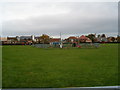
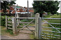
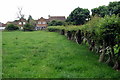
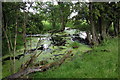
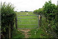
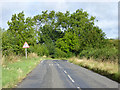
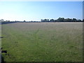
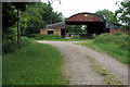
8 photos from this area
Area Information
Key information about the MK43 0BP including its size, population, and administrative classification.
- Area Type
- Postcode
- Area Size
- 1.6 hectares
- Population
- 1476
- Population Density
- 1211 people/km²
House Prices in MK43 0BP
44
Properties
£220,269
Average Sold Price
£52,000
Lowest Price
£390,000
Highest Price
Showing 44 properties
| Address | Type | Beds | Baths | Last Sale Price | Last Sale Date | |
|---|---|---|---|---|---|---|
| 70 Partridge Piece, Cranfield, MK43 0BP | Semi-detached | 3 | 2 | £365,000 | Jan 2025 | |
| 54 Partridge Piece, Cranfield, MK43 0BP | house | 3 | 1 | £370,000 | Jun 2024 | |
| 42 Partridge Piece, Cranfield, MK43 0BP | Detached | 4 | 2 | £390,000 | Apr 2024 | |
| 68 Partridge Piece, Cranfield, MK43 0BP | house | 4 | 2 | £388,000 | Nov 2023 | |
| 84 Partridge Piece, Cranfield, MK43 0BP | Semi-detached | 3 | 1 | £317,500 | Jun 2022 | |
| 36 Partridge Piece, Cranfield, MK43 0BP | Semi-detached | 3 | 1 | £341,500 | Nov 2021 | |
| 2 Partridge Piece, Cranfield, MK43 0BP | Semi-detached | 3 | 2 | £355,000 | Jun 2021 | |
| 40 Partridge Piece, Cranfield, MK43 0BP | house | - | - | £325,000 | Jun 2021 | |
| 50 Partridge Piece, Cranfield, MK43 0BP | Detached | 3 | 1 | £317,500 | Mar 2021 | |
| 88 Partridge Piece, Cranfield, MK43 0BP | Semi-detached | 3 | 1 | £245,000 | Apr 2019 |
Page 1 of 5
Energy Efficiency in MK43 0BP
Amenities
Schools
| Rank | School | Type | Entry gender | Ages |
|---|
Explore more schools in this area
Go to Schools tabDemographics
Household Size
Family (3-5 people)
most common
Accommodation Type
Houses
most common
Tenure
72
majority
Ethnic Group
White
most common
Religion
N/A
most common
Household Composition
N/A
most common
Age
47
median
Adults (30-64 years)
most common
Household Deprivation
N/A
with no deprivation
NS-SEC
34
in Lower managerial occupations
Explore more demographic insights in this area
Go to Demographics tabPlanning
Planning Constraints
- Flood RiskPremium
- Ramsar Wetland SitesPremium
- Area of Outstanding Natural BeautyPremium
- Protected Nature ReservePremium
- Protected WoodlandPremium