Area Overview for MK43 0AY
Photos of MK43 0AY


Area Information
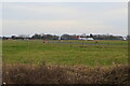
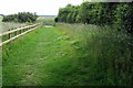
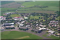
Living in MK43 0AY offers a compact, low-density residential experience in a small cluster of homes. With a population of 1,885 spread across 3.1 hectares, the area maintains a quiet, community-focused character. The population density of 101 people per square kilometre suggests a balance between privacy and proximity to essential services. This postcode is notable for its young demographic, with a median age of 22 and a majority of residents aged 15–29. The presence of Cranfield University nearby adds a layer of academic and professional opportunity, though the area itself is primarily residential. Daily life here is shaped by its small size and the availability of nearby rail connections, which link residents to larger towns. The mix of homes and the relatively low population density create a sense of space, making MK43 0AY a niche choice for those seeking a tranquil, compact living environment without the pressures of urban density.
- Area Type
- Postcode
- Area Size
- 3.1 hectares
- Population
- 1885
- Population Density
- 101 people/km²
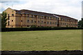
MK43 0AY is a small, owner-occupied area where 63% of residents live in houses rather than flats or rental properties. The housing stock is limited by the area’s size, which spans just 3.1 hectares, meaning the number of available homes is restricted. This makes the property market niche, with buyers likely needing to consider surrounding areas for more options. The focus on houses suggests a preference for standalone living, which may appeal to families or individuals seeking privacy. However, the compact nature of the postcode means that property availability is unlikely to be extensive. For buyers, this could translate to a need for flexibility in location, as the immediate area offers few properties but is well-connected to rail networks and Cranfield Airport, which might offset the limited local stock.
House Prices in MK43 0AY
No properties found in this postcode.
Energy Efficiency in MK43 0AY
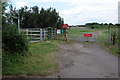
Residents of MK43 0AY have access to a range of nearby amenities, including five retail outlets such as The Southern Co-operative Co, Co-op Cranfield, and Morrisons Daily. These shops provide essential grocery and retail services within practical reach. The area’s rail stations offer convenient links to surrounding towns, while Cranfield Airport adds to the transport options. Although the data does not list parks or leisure facilities directly, the proximity to rail and retail suggests a functional lifestyle focused on connectivity and convenience. The small size of the area means that amenities are compact but sufficient for daily needs, with the nearby rail network and retail options forming the backbone of local life.
Amenities
Schools
The nearest educational institution to MK43 0AY is Cranfield University, categorised as an 'other' type in the data. While the area does not list primary or secondary schools, the presence of a university nearby may benefit residents seeking higher education or professional development opportunities. For families requiring schools for younger children, the data does not provide specific details, so further research would be necessary to identify nearby primary or secondary schools. The absence of listed schools in the immediate vicinity suggests that residents may need to look beyond MK43 0AY for comprehensive educational facilities. This could be a consideration for homebuyers prioritising proximity to schools for children.
| Rank | School | Type | Entry gender | Ages |
|---|---|---|---|---|
| 1 | Cranfield University | other | N/A | N/A |
Explore more schools in this area
Go to Schools tabDemographics
The community in MK43 0AY is predominantly young, with a median age of 22 and the largest age group being 15–29 years. This reflects a student or early-career population, likely influenced by the proximity to Cranfield University. Home ownership is strong, with 63% of residents owning their homes, and the accommodation type is primarily houses, indicating a preference for standalone properties over flats. The predominant ethnic group is White, though no specific diversity statistics are provided. The low population density of 101 people per square kilometre suggests a spread-out, less congested living environment. While the data does not include deprivation metrics, the combination of young residents, home ownership, and a focus on houses implies a stable, self-sufficient community. However, the small size of the area and limited local amenities may require residents to rely on nearby towns for broader services.
Household Size
Accommodation Type
Tenure
Ethnic Group
Religion
Household Composition
Age
Household Deprivation
NS-SEC
Explore more demographic insights in this area
Go to Demographics tabPlanning
Planning Constraints
- Flood RiskPremium
- Ramsar Wetland SitesPremium
- Area of Outstanding Natural BeautyPremium
- Protected Nature ReservePremium
- Protected WoodlandPremium
- Crime RiskPremium