Area Overview for MK43 0AJ
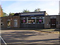
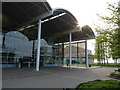
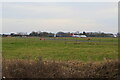
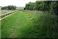
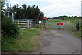
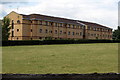
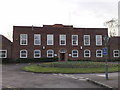
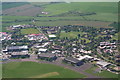
Photos of MK43 0AJ


Area Information
MK43 0AJ is a compact residential postcode in England, covering 9.2 hectares and home to 1,364 residents. Its population density of 211 people per square kilometre suggests a tight-knit community, where proximity to amenities and services is a key feature. The area’s small size means it is likely a quiet, low-traffic neighbourhood, ideal for those seeking a balance between suburban comfort and accessible connectivity. Residents benefit from being near Cranfield Airport, which could be a draw for those working in aviation or requiring frequent travel. The presence of five nearby railway stations, including Lidlington and Aspley Guise, offers reliable commuting options to larger towns. With a median age of 47 and a population skewed towards adults aged 30–64, this area appeals to families and professionals looking for stability. The low flood risk and below-average crime rates further enhance its appeal, making it a practical choice for buyers prioritising safety and reliability.
- Area Type
- Postcode
- Area Size
- 9.2 hectares
- Population
- 1364
- Population Density
- 211 people/km²
MK43 0AJ is primarily an owner-occupied area, with 76% of homes owned by residents rather than rented. The housing stock consists mainly of houses, which contrasts with areas dominated by flats or apartments. This suggests a market skewed towards families or professionals seeking private, low-density living. Given the small size of the postcode, the property options may be limited to individual homes rather than larger developments. Buyers should consider that the area’s proximity to rail links and Cranfield Airport could make it attractive to those requiring easy access to transport. However, the small population and limited size of the area mean that the immediate surroundings may hold more diverse property options. For buyers prioritising home ownership, this area offers a stable, low-risk environment with a focus on traditional housing.
House Prices in MK43 0AJ
Showing 1 properties
| Address | Type | Beds | Baths | Last Sale Price | Last Sale Date | |
|---|---|---|---|---|---|---|
| British Hydromechanics Research Association, College Road, Cranfield, MK43 0AJ | warehouse | - | - | - | - |
Energy Efficiency in MK43 0AJ
Living in MK43 0AJ offers access to a range of local amenities, including five retail outlets such as The Southern Co-operative Co, Co-op Cranfield, and Morrisons Daily. These shops provide everyday essentials, reducing the need for long trips to larger towns. The area’s railway stations, including Lidlington and Aspley Guise, connect residents to broader networks for leisure, shopping, and employment. While specific parks or leisure facilities are not listed, the low population density and absence of environmental constraints suggest open spaces may be available nearby. The presence of multiple rail links and retail options enhances the area’s convenience, supporting a lifestyle that balances local self-sufficiency with easy access to external opportunities.
Amenities
Schools
| Rank | School | Type | Entry gender | Ages |
|---|
Explore more schools in this area
Go to Schools tabDemographics
The community in MK43 0AJ is predominantly composed of adults aged 30–64, with a median age of 47. This suggests a mature population, likely with established careers and families. Home ownership is high, with 76% of residents living in owner-occupied properties, indicating a stable housing market. The area is characterised by houses rather than flats, aligning with the preferences of those seeking private, spacious living. The predominant ethnic group is White, reflecting a homogenous demographic profile. With a population of 1,364, the area is small enough to foster a sense of familiarity but large enough to support local amenities. The absence of specific deprivation data means no direct commentary on economic challenges, but the high home ownership rate and low crime score imply a generally secure and self-sufficient community.
Household Size
Accommodation Type
Tenure
Ethnic Group
Religion
Household Composition
Age
Household Deprivation
NS-SEC
Explore more demographic insights in this area
Go to Demographics tabPlanning
Planning Constraints
- Flood RiskPremium
- Ramsar Wetland SitesPremium
- Area of Outstanding Natural BeautyPremium
- Protected Nature ReservePremium
- Protected WoodlandPremium