Area Overview for MK17 8TN
Photos of MK17 8TN
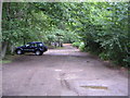
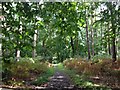


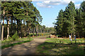

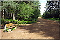

13 photos from this area
Area Information
Key information about the MK17 8TN including its size, population, and administrative classification.
- Area Type
- Postcode
- Area Size
- 7.3 hectares
- Population
- 1241
- Population Density
- 149 people/km²
House Prices in MK17 8TN
23
Properties
£980,462
Average Sold Price
£245,000
Lowest Price
£1,825,000
Highest Price
Showing 23 properties
| Address | Type | Beds | Baths | Last Sale Price | Last Sale Date | |
|---|---|---|---|---|---|---|
| The Old Coach House, Heath Lane, Aspley Heath, MK17 8TN | house | - | - | £1,525,000 | Jan 2022 | |
| Grenair, Heath Lane, Aspley Heath, MK17 8TN | Detached | 5 | 4 | £1,115,000 | Apr 2021 | |
| Oakwood, Heath Lane, Aspley Heath, MK17 8TN | house | - | - | £1,015,000 | Dec 2019 | |
| Aldermans Place, Heath Lane, Aspley Heath, MK17 8TN | Detached | 5 | - | £1,825,000 | Dec 2019 | |
| Willow Bank, Heath Lane, Aspley Heath, MK17 8TN | house | - | - | £971,000 | Jun 2016 | |
| Tree Tops, Heath Lane, Aspley Heath, MK17 8TN | house | - | - | £1,175,000 | Jul 2015 | |
| Twinwood, Heath Lane, Aspley Heath, MK17 8TN | Detached | 4 | 2 | £860,000 | Dec 2014 | |
| The Oaks, Heath Lane, Aspley Heath, MK17 8TN | Detached | 6 | - | £1,765,000 | Oct 2014 | |
| High Pines, Heath Lane, Aspley Heath, MK17 8TN | house | - | - | £530,000 | Jun 2010 | |
| Latchmoor House, Heath Lane, Aspley Heath, MK17 8TN | house | - | - | £620,000 | Mar 2009 |
Page 1 of 3
Energy Efficiency in MK17 8TN
Amenities
Schools
| Rank | School | Type | Entry gender | Ages |
|---|
Explore more schools in this area
Go to Schools tabDemographics
Household Size
One person
most common
Accommodation Type
Houses
most common
Tenure
64
majority
Ethnic Group
White
most common
Religion
N/A
most common
Household Composition
N/A
most common
Age
47
median
Adults (30-64 years)
most common
Household Deprivation
N/A
with no deprivation
NS-SEC
46
in Lower managerial occupations
Explore more demographic insights in this area
Go to Demographics tabPlanning
Planning Constraints
- Flood RiskPremium
- Ramsar Wetland SitesPremium
- Area of Outstanding Natural BeautyPremium
- Protected Nature ReservePremium
- Protected WoodlandPremium