Area Overview for LU7 2XJ
Photos of LU7 2XJ
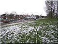
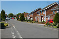
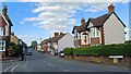
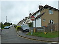
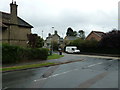
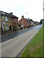
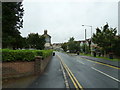
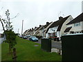
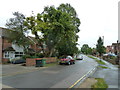
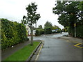
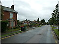
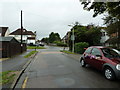
34 photos from this area
Area Information
Key information about the LU7 2XJ including its size, population, and administrative classification.
- Area Type
- Postcode
- Area Size
- 1.4 hectares
- Population
- 1457
- Population Density
- 1045 people/km²
House Prices in LU7 2XJ
38
Properties
£262,452
Average Sold Price
£53,000
Lowest Price
£570,000
Highest Price
Showing 38 properties
| Address | Type | Beds | Baths | Last Sale Price | Last Sale Date | |
|---|---|---|---|---|---|---|
| 23 Blakedown Road, Linslade, LU7 2XJ | Detached | 4 | 2 | £570,000 | Dec 2025 | |
| 36 Blakedown Road, Linslade, LU7 2XJ | Retail | 3 | 2 | £402,000 | May 2022 | |
| 12 Blakedown Road, Linslade, LU7 2XJ | Semi-detached | 3 | 1 | £360,000 | Jan 2021 | |
| 30 Blakedown Road, Linslade, LU7 2XJ | Detached | 4 | - | £437,500 | Dec 2020 | |
| 2 Blakedown Road, Linslade, LU7 2XJ | house | - | - | £380,000 | Sep 2020 | |
| 15 Blakedown Road, Linslade, LU7 2XJ | Detached | 4 | 1 | £437,500 | Aug 2017 | |
| 37 Blakedown Road, Linslade, LU7 2XJ | Semi-detached | 3 | 1 | £300,000 | Jun 2016 | |
| 9 Blakedown Road, Linslade, LU7 2XJ | Detached | 3 | - | £320,000 | Oct 2015 | |
| 20 Blakedown Road, Linslade, LU7 2XJ | house | - | - | £250,000 | Sep 2013 | |
| 10 Blakedown Road, Linslade, LU7 2XJ | Detached | 3 | - | £193,000 | May 2013 |
Page 1 of 4
Energy Efficiency in LU7 2XJ
Amenities
Schools
| Rank | School | Type | Entry gender | Ages |
|---|
Explore more schools in this area
Go to Schools tabDemographics
Household Size
Family (3-5 people)
most common
Accommodation Type
Houses
most common
Tenure
81
majority
Ethnic Group
White
most common
Religion
N/A
most common
Household Composition
N/A
most common
Age
47
median
Adults (30-64 years)
most common
Household Deprivation
N/A
with no deprivation
NS-SEC
42
in Lower managerial occupations
Explore more demographic insights in this area
Go to Demographics tabPlanning
Planning Constraints
- Flood RiskPremium
- Ramsar Wetland SitesPremium
- Area of Outstanding Natural BeautyPremium
- Protected Nature ReservePremium
- Protected WoodlandPremium