Area Overview for LU7 2QW
Photos of LU7 2QW
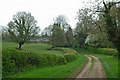
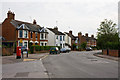
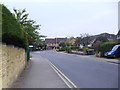
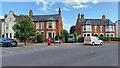
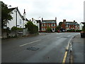
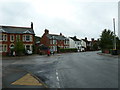
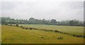
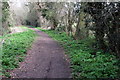
16 photos from this area
Area Information
Key information about the LU7 2QW including its size, population, and administrative classification.
- Area Type
- Postcode
- Area Size
- 1.5 hectares
- Population
- 1457
- Population Density
- 1045 people/km²
House Prices in LU7 2QW
33
Properties
£296,940
Average Sold Price
£59,000
Lowest Price
£490,000
Highest Price
Showing 33 properties
| Address | Type | Beds | Baths | Last Sale Price | Last Sale Date | |
|---|---|---|---|---|---|---|
| 14 Derwent Road, Linslade, LU7 2QW | Detached | 4 | 1 | £475,000 | Oct 2024 | |
| 38 Derwent Road, Linslade, LU7 2QW | Detached | 4 | 1 | £472,000 | Mar 2024 | |
| 12 Derwent Road, Linslade, LU7 2QW | Detached | 4 | 1 | £425,000 | Jun 2021 | |
| 34 Derwent Road, Linslade, LU7 2QW | house | 5 | - | £490,000 | Nov 2020 | |
| 10 Derwent Road, Linslade, LU7 2QW | Detached | 3 | 1 | £350,000 | Dec 2019 | |
| 48 Derwent Road, Linslade, LU7 2QW | house | - | - | £485,000 | Dec 2018 | |
| 44 Derwent Road, Linslade, LU7 2QW | Detached | 4 | 2 | £462,500 | Nov 2018 | |
| 32 Derwent Road, Linslade, LU7 2QW | Detached | 4 | 1 | £420,000 | Aug 2018 | |
| 62 Derwent Road, Linslade, LU7 2QW | Detached | 4 | 2 | £440,000 | Apr 2018 | |
| 2 Derwent Road, Linslade, LU7 2QW | house | - | - | £432,000 | Jan 2018 |
Page 1 of 4
Energy Efficiency in LU7 2QW
Amenities
Schools
| Rank | School | Type | Entry gender | Ages |
|---|
Explore more schools in this area
Go to Schools tabDemographics
Household Size
Family (3-5 people)
most common
Accommodation Type
Houses
most common
Tenure
81
majority
Ethnic Group
White
most common
Religion
N/A
most common
Household Composition
N/A
most common
Age
47
median
Adults (30-64 years)
most common
Household Deprivation
N/A
with no deprivation
NS-SEC
42
in Lower managerial occupations
Explore more demographic insights in this area
Go to Demographics tabPlanning
Planning Constraints
- Flood RiskPremium
- Ramsar Wetland SitesPremium
- Area of Outstanding Natural BeautyPremium
- Protected Nature ReservePremium
- Protected WoodlandPremium