Area Overview for LU7 2TL
Photos of LU7 2TL
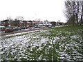
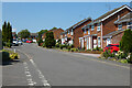
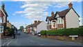
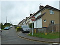
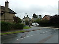
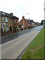
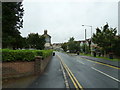
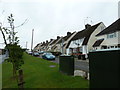
34 photos from this area
Area Information
Key information about the LU7 2TL including its size, population, and administrative classification.
- Area Type
- Postcode
- Area Size
- 1.9 hectares
- Population
- 1280
- Population Density
- 6410 people/km²
House Prices in LU7 2TL
55
Properties
£253,363
Average Sold Price
£64,500
Lowest Price
£460,000
Highest Price
Showing 55 properties
| Address | Type | Beds | Baths | Last Sale Price | Last Sale Date | |
|---|---|---|---|---|---|---|
| 164 Bideford Green, Linslade, LU7 2TL | Detached | 3 | 2 | £460,000 | Dec 2025 | |
| 112 Bideford Green, Linslade, LU7 2TL | Semi-detached | 3 | 1 | £320,000 | Oct 2025 | |
| 152 Bideford Green, Linslade, LU7 2TL | Detached | 3 | 1 | £385,000 | Mar 2025 | |
| 134 Bideford Green, Linslade, LU7 2TL | Terraced | 3 | 1 | £365,000 | Mar 2025 | |
| 146 Bideford Green, Linslade, LU7 2TL | Detached | 3 | 1 | £375,000 | Apr 2023 | |
| 133 Bideford Green, Linslade, LU7 2TL | Terraced | 3 | 1 | £355,000 | Dec 2022 | |
| 148 Bideford Green, Linslade, LU7 2TL | house | 3 | 1 | £380,000 | Oct 2022 | |
| 158 Bideford Green, Linslade, LU7 2TL | Detached | 3 | 1 | £310,000 | Jun 2022 | |
| 160 Bideford Green, Linslade, LU7 2TL | Retail | 3 | 1 | £415,000 | Jun 2022 | |
| 115 Bideford Green, Linslade, LU7 2TL | house | 3 | - | £300,000 | Mar 2021 |
Page 1 of 6
Energy Efficiency in LU7 2TL
Amenities
Schools
| Rank | School | Type | Entry gender | Ages |
|---|
Explore more schools in this area
Go to Schools tabDemographics
Household Size
Family (3-5 people)
most common
Accommodation Type
Houses
most common
Tenure
85
majority
Ethnic Group
White
most common
Religion
N/A
most common
Household Composition
N/A
most common
Age
47
median
Adults (30-64 years)
most common
Household Deprivation
N/A
with no deprivation
NS-SEC
43
in Lower managerial occupations
Explore more demographic insights in this area
Go to Demographics tabPlanning
Planning Constraints
- Flood RiskPremium
- Ramsar Wetland SitesPremium
- Area of Outstanding Natural BeautyPremium
- Protected Nature ReservePremium
- Protected WoodlandPremium