Area Overview for LU6 2AH
Photos of LU6 2AH
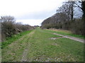
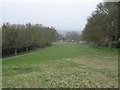
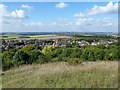

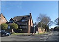
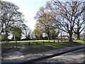
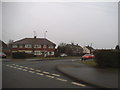
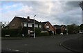
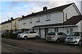

29 photos from this area
Area Information
Key information about the LU6 2AH including its size, population, and administrative classification.
- Area Type
- Postcode
- Area Size
- 2.5 hectares
- Population
- 1456
- Population Density
- 1909 people/km²
House Prices in LU6 2AH
55
Properties
£283,939
Average Sold Price
£6,000
Lowest Price
£515,000
Highest Price
Showing 55 properties
| Address | Type | Beds | Baths | Last Sale Price | Last Sale Date | |
|---|---|---|---|---|---|---|
| 40 Marina Drive, Dunstable, LU6 2AH | Bungalow | 2 | 1 | £390,000 | Oct 2025 | |
| 3 Marina Drive, Dunstable, LU6 2AH | Semi-detached | 3 | 2 | £445,000 | Feb 2025 | |
| 27 Marina Drive, Dunstable, LU6 2AH | Semi-detached | 5 | 2 | £480,000 | Sep 2024 | |
| 25 Marina Drive, Dunstable, LU6 2AH | Semi-detached | 3 | 1 | £415,000 | Dec 2022 | |
| 22 Marina Drive, Dunstable, LU6 2AH | house | - | - | £476,000 | Jul 2022 | |
| 42 Marina Drive, Dunstable, LU6 2AH | Semi-detached | 2 | 1 | £310,000 | Sep 2021 | |
| 31 Marina Drive, Dunstable, LU6 2AH | house | - | - | £420,000 | Jul 2021 | |
| 60 Marina Drive, Dunstable, LU6 2AH | Bungalow | - | - | £312,000 | Jun 2021 | |
| 62 Marina Drive, Dunstable, LU6 2AH | Bungalow | - | - | £300,000 | May 2021 | |
| 52 Marina Drive, Dunstable, LU6 2AH | Bungalow | - | - | £378,500 | Apr 2021 |
Page 1 of 6
Energy Efficiency in LU6 2AH
Amenities
Schools
| Rank | School | Type | Entry gender | Ages |
|---|
Explore more schools in this area
Go to Schools tabDemographics
Household Size
Two person
most common
Accommodation Type
Houses
most common
Tenure
93
majority
Ethnic Group
White
most common
Religion
N/A
most common
Household Composition
N/A
most common
Age
47
median
Adults (30-64 years)
most common
Household Deprivation
N/A
with no deprivation
NS-SEC
41
in Lower managerial occupations
Explore more demographic insights in this area
Go to Demographics tabPlanning
Planning Constraints
- Flood RiskPremium
- Ramsar Wetland SitesPremium
- Area of Outstanding Natural BeautyPremium
- Protected Nature ReservePremium
- Protected WoodlandPremium