Area Overview for LU6 1LZ
Photos of LU6 1LZ


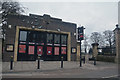
59 photos from this area
Area Information
Key information about the LU6 1LZ including its size, population, and administrative classification.
- Area Type
- Postcode
- Area Size
- 2.3 hectares
- Population
- 1605
- Population Density
- 5569 people/km²
House Prices in LU6 1LZ
65
Properties
£194,875
Average Sold Price
£50,000
Lowest Price
£375,000
Highest Price
Showing 65 properties
| Address | Type | Beds | Baths | Last Sale Price | Last Sale Date | |
|---|---|---|---|---|---|---|
| 43 Beale Street, Dunstable, LU6 1LZ | Terraced | 4 | 1 | £375,000 | Mar 2025 | |
| 65 Beale Street, Dunstable, LU6 1LZ | Terraced | 3 | 2 | £265,000 | Mar 2025 | |
| 46 Beale Street, Dunstable, LU6 1LZ | Terraced | 5 | 2 | £342,500 | Nov 2024 | |
| 47 Beale Street, Dunstable, LU6 1LZ | Semi-detached | 3 | 1 | £285,000 | Nov 2023 | |
| 32 Beale Street, Dunstable, LU6 1LZ | Terraced | 3 | 1 | £281,000 | Jun 2023 | |
| 72 Beale Street, Dunstable, LU6 1LZ | Detached | 3 | 1 | £320,000 | Feb 2023 | |
| 42 Beale Street, Dunstable, LU6 1LZ | Terraced | 4 | 2 | £325,000 | Dec 2022 | |
| 54 Beale Street, Dunstable, LU6 1LZ | house | 4 | 1 | £320,000 | Apr 2022 | |
| 57 Beale Street, Dunstable, LU6 1LZ | Flat | - | - | £170,000 | Sep 2021 | |
| 25 Beale Street, Dunstable, LU6 1LZ | house | 3 | - | £290,000 | May 2021 |
Page 1 of 7
Energy Efficiency in LU6 1LZ
Amenities
Schools
| Rank | School | Type | Entry gender | Ages |
|---|
Explore more schools in this area
Go to Schools tabDemographics
Household Size
Family (3-5 people)
most common
Accommodation Type
Houses
most common
Tenure
63
majority
Ethnic Group
White
most common
Religion
N/A
most common
Household Composition
N/A
most common
Age
47
median
Adults (30-64 years)
most common
Household Deprivation
N/A
with no deprivation
NS-SEC
29
in Lower managerial occupations
Explore more demographic insights in this area
Go to Demographics tabPlanning
Planning Constraints
- Flood RiskPremium
- Ramsar Wetland SitesPremium
- Area of Outstanding Natural BeautyPremium
- Protected Nature ReservePremium
- Protected WoodlandPremium