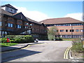
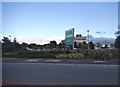
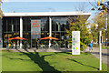
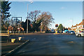
Area Overview for LU6 1LF
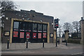
Photos of LU6 1LF


Area Information
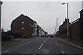
LU6 1LF is a compact residential postcode in England, spanning 8,042 square metres and home to 1,605 residents. Its high population density of 199,573 people per square kilometre reflects a tightly knit community, where proximity to amenities and transport links is a defining feature. The area’s character is shaped by its mix of local shops, railway access, and a predominantly owner-occupied housing stock. With a median age of 47, the population skews toward adults aged 30–64, suggesting a stable demographic of professionals and families. Daily life here balances practicality with accessibility, with nearby rail stations and retail outlets within walking distance. While the area lacks natural constraints like protected woodlands or wetlands, its small footprint means residents are close to both urban conveniences and the quieter aspects of suburban living. For those seeking a self-contained, community-focused environment with strong transport links, LU6 1LF offers a blend of practicality and connectivity.
- Area Type
- Postcode
- Area Size
- 8042 m²
- Population
- 1605
- Population Density
- 5569 people/km²
The property market in LU6 1LF is largely driven by owner-occupation, with 63% of residents owning their homes. This contrasts with areas where rental markets dominate, indicating a preference for long-term residency. The accommodation type is predominantly houses, which is unusual for a small postcode area but may reflect a focus on family homes or detached properties. Given the limited area size of 8,042 square metres, the housing stock is constrained, meaning buyers should consider the proximity to surrounding areas for more options. The high home ownership rate suggests strong community ties, but it also means the market may be less dynamic for renters. For buyers, the emphasis on houses could appeal to those seeking space, though the area’s compact nature means local amenities are prioritised over expansive land use.
House Prices in LU6 1LF
Showing 1 properties
| Address | Type | Beds | Baths | Last Sale Price | Last Sale Date | |
|---|---|---|---|---|---|---|
| Job Centre, Watling House, High Street North, Dunstable, LU6 1LF | primary_healthcare | - | - | - | - |
Energy Efficiency in LU6 1LF
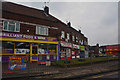
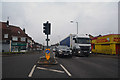
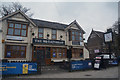
Living in LU6 1LF offers access to a range of local amenities, including five retail outlets such as Tesco Dunstable High, Co-op Dunstable, and Iceland Dunstable. These shops provide essential groceries and household goods, reducing the need for long journeys. The area’s rail connections to Leagrave, Harlington, and Luton stations offer easy access to broader services, from healthcare to entertainment. While the data does not specify parks or leisure facilities, the absence of environmental constraints like protected woodlands or wetlands suggests open spaces may be limited. Nonetheless, the proximity to retail and transport hubs creates a convenient lifestyle, ideal for those prioritising accessibility over expansive green spaces. The character of daily life here is defined by practicality, with residents able to meet most needs within a short distance of their homes.
Amenities
Schools
| Rank | School | Type | Entry gender | Ages |
|---|
Explore more schools in this area
Go to Schools tabDemographics
The community in LU6 1LF is predominantly composed of adults aged 30–64, with a median age of 47. This suggests a mature, established population, likely comprising professionals and families. Home ownership is high at 63%, indicating a stable housing market where most residents live in their own homes rather than renting. The accommodation type is primarily houses, which aligns with the area’s residential character and the absence of high-density housing. The predominant ethnic group is White, reflecting a homogenous demographic profile. While the data does not specify deprivation levels, the high home ownership and age profile suggest a relatively stable economic environment. However, the average age and moderate population size mean the area may lack the diversity of younger or more transient populations.
Household Size
Accommodation Type
Tenure
Ethnic Group
Religion
Household Composition
Age
Household Deprivation
NS-SEC
Explore more demographic insights in this area
Go to Demographics tabPlanning
Planning Constraints
- Flood RiskPremium
- Ramsar Wetland SitesPremium
- Area of Outstanding Natural BeautyPremium
- Protected Nature ReservePremium
- Protected WoodlandPremium