Area Overview for LU6 1LP
Photos of LU6 1LP


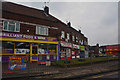
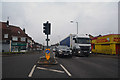
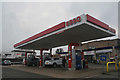
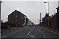
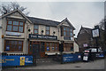

59 photos from this area
Area Information
Key information about the LU6 1LP including its size, population, and administrative classification.
- Area Type
- Postcode
- Area Size
- 6045 m²
- Population
- 1835
- Population Density
- 8207 people/km²
House Prices in LU6 1LP
20
Properties
£186,600
Average Sold Price
£71,000
Lowest Price
£295,000
Highest Price
Showing 20 properties
| Address | Type | Beds | Baths | Last Sale Price | Last Sale Date | |
|---|---|---|---|---|---|---|
| 13 Regent Street, Dunstable, LU6 1LP | Terraced | 2 | 1 | £295,000 | Jun 2025 | |
| 19 Regent Street, Dunstable, LU6 1LP | Terraced | 3 | 1 | £265,000 | Dec 2023 | |
| 3 Regent Street, Dunstable, LU6 1LP | Terraced | 2 | 1 | £225,000 | Feb 2019 | |
| 15 Regent Street, Dunstable, LU6 1LP | Terraced | 2 | 1 | £225,000 | Apr 2018 | |
| 3B Regent Street, Dunstable, LU6 1LP | Terraced | 2 | 1 | £225,000 | Dec 2016 | |
| 3A Regent Street, Dunstable, LU6 1LP | Terraced | 2 | 1 | £210,000 | May 2016 | |
| 14 Regent Street, Dunstable, LU6 1LP | house | - | - | £140,000 | Jul 2014 | |
| 21 Regent Street, Dunstable, LU6 1LP | house | 1 | 1 | £137,500 | Oct 2013 | |
| 4 Regent Street, Dunstable, LU6 1LP | house | 3 | - | £190,000 | Dec 2011 | |
| 11 Regent Street, Dunstable, LU6 1LP | Terraced | 2 | 2 | £152,000 | Dec 2009 |
Page 1 of 2
Energy Efficiency in LU6 1LP
Amenities
Schools
| Rank | School | Type | Entry gender | Ages |
|---|
Explore more schools in this area
Go to Schools tabDemographics
Household Size
One person
most common
Accommodation Type
Houses
most common
Tenure
56
majority
Ethnic Group
White
most common
Religion
N/A
most common
Household Composition
N/A
most common
Age
47
median
Adults (30-64 years)
most common
Household Deprivation
N/A
with no deprivation
NS-SEC
30
in Lower managerial occupations
Explore more demographic insights in this area
Go to Demographics tabPlanning
Planning Constraints
- Flood RiskPremium
- Ramsar Wetland SitesPremium
- Area of Outstanding Natural BeautyPremium
- Protected Nature ReservePremium
- Protected WoodlandPremium