Area Overview for LU4 0PH
Photos of LU4 0PH
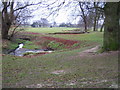
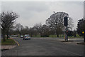
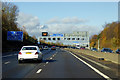
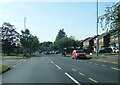


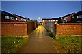
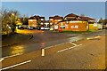
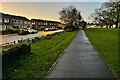
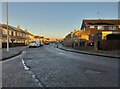
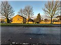
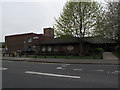
24 photos from this area
Area Information
Key information about the LU4 0PH including its size, population, and administrative classification.
- Area Type
- Postcode
- Area Size
- 6511 m²
- Population
- 1468
- Population Density
- 4510 people/km²
House Prices in LU4 0PH
34
Properties
£161,333
Average Sold Price
£91,000
Lowest Price
£377,000
Highest Price
Showing 34 properties
| Address | Type | Beds | Baths | Last Sale Price | Last Sale Date | |
|---|---|---|---|---|---|---|
| 98 Drayton Road, Luton, LU4 0PH | Flat | 1 | 1 | £148,000 | Jul 2025 | |
| 120 Drayton Road, Luton, LU4 0PH | Retail | 4 | 2 | £377,000 | Sep 2022 | |
| 116 Drayton Road, Luton, LU4 0PH | Flat | - | - | £105,000 | Aug 2020 | |
| 70 Drayton Road, Luton, LU4 0PH | Terraced | 3 | 1 | £235,000 | Jul 2017 | |
| 110 Drayton Road, Luton, LU4 0PH | Flat | 1 | 1 | £102,000 | Aug 2015 | |
| 56 Drayton Road, Luton, LU4 0PH | house | - | - | £130,000 | Jan 2012 | |
| 102 Drayton Road, Luton, LU4 0PH | Flat | - | - | £91,000 | Feb 2008 | |
| 74 Drayton Road, Luton, LU4 0PH | house | - | - | £119,000 | Nov 2006 | |
| 118 Drayton Road, Luton, LU4 0PH | house | - | - | £145,000 | Nov 2005 | |
| 54 Drayton Road, Luton, LU4 0PH | Detached | 3 | - | - | - |
Page 1 of 4
Energy Efficiency in LU4 0PH
Amenities
Schools
| Rank | School | Type | Entry gender | Ages |
|---|
Explore more schools in this area
Go to Schools tabDemographics
Household Size
One person
most common
Accommodation Type
Houses
most common
Tenure
39
majority
Ethnic Group
White
most common
Religion
N/A
most common
Household Composition
N/A
most common
Age
47
median
Adults (30-64 years)
most common
Household Deprivation
N/A
with no deprivation
NS-SEC
20
in Lower managerial occupations
Explore more demographic insights in this area
Go to Demographics tabPlanning
Planning Constraints
- Flood RiskPremium
- Ramsar Wetland SitesPremium
- Area of Outstanding Natural BeautyPremium
- Protected Nature ReservePremium
- Protected WoodlandPremium