Area Overview for LU3 2TB
Photos of LU3 2TB
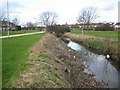

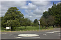
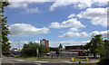
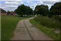
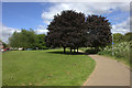
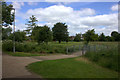
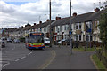
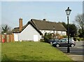
9 photos from this area
Area Information
Key information about the LU3 2TB including its size, population, and administrative classification.
- Area Type
- Postcode
- Area Size
- 3.0 hectares
- Population
- 1671
- Population Density
- 5280 people/km²
House Prices in LU3 2TB
28
Properties
£235,763
Average Sold Price
£65,750
Lowest Price
£395,000
Highest Price
Showing 28 properties
| Address | Type | Beds | Baths | Last Sale Price | Last Sale Date | |
|---|---|---|---|---|---|---|
| 15 Watermead Road, Luton, LU3 2TB | Semi-detached | 3 | 1 | £340,000 | May 2024 | |
| 29 Watermead Road, Luton, LU3 2TB | Semi-detached | 3 | 1 | £366,000 | Feb 2024 | |
| 25 Watermead Road, Luton, LU3 2TB | house | - | - | £375,000 | Jun 2021 | |
| 11 Watermead Road, Luton, LU3 2TB | house | - | - | £292,500 | Sep 2020 | |
| 51 Watermead Road, Luton, LU3 2TB | Semi-detached | 3 | 1 | £300,000 | Jul 2019 | |
| 49 Watermead Road, Luton, LU3 2TB | Semi-detached | 3 | 2 | £305,000 | Dec 2018 | |
| 17 Watermead Road, Luton, LU3 2TB | house | 3 | - | £395,000 | Jul 2018 | |
| 13 Watermead Road, Luton, LU3 2TB | house | - | - | £290,000 | Jun 2017 | |
| 35 Watermead Road, Luton, LU3 2TB | house | - | - | £285,000 | Jul 2016 | |
| 55 Watermead Road, Luton, LU3 2TB | house | - | - | £200,000 | Mar 2016 |
Page 1 of 3
Energy Efficiency in LU3 2TB
Amenities
Schools
| Rank | School | Type | Entry gender | Ages |
|---|
Explore more schools in this area
Go to Schools tabDemographics
Household Size
Family (3-5 people)
most common
Accommodation Type
Houses
most common
Tenure
83
majority
Ethnic Group
White
most common
Religion
N/A
most common
Household Composition
N/A
most common
Age
47
median
Adults (30-64 years)
most common
Household Deprivation
N/A
with no deprivation
NS-SEC
23
in Lower managerial occupations
Explore more demographic insights in this area
Go to Demographics tabPlanning
Planning Constraints
- Flood RiskPremium
- Ramsar Wetland SitesPremium
- Area of Outstanding Natural BeautyPremium
- Protected Nature ReservePremium
- Protected WoodlandPremium