Area Overview for LU3 2AP
Photos of LU3 2AP
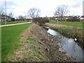
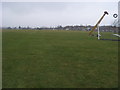
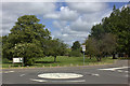
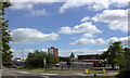
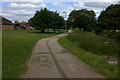
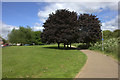
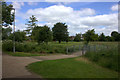
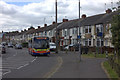
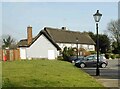
9 photos from this area
Area Information
Key information about the LU3 2AP including its size, population, and administrative classification.
- Area Type
- Postcode
- Area Size
- 5.5 hectares
- Population
- 1655
- Population Density
- 2809 people/km²
House Prices in LU3 2AP
48
Properties
£298,798
Average Sold Price
£68,000
Lowest Price
£520,000
Highest Price
Showing 48 properties
| Address | Type | Beds | Baths | Last Sale Price | Last Sale Date | |
|---|---|---|---|---|---|---|
| 11 Truro Gardens, Luton, LU3 2AP | house | - | - | £430,000 | Feb 2025 | |
| 6 Truro Gardens, Luton, LU3 2AP | Detached | 3 | 1 | £425,000 | Nov 2024 | |
| 8 Truro Gardens, Luton, LU3 2AP | house | - | - | £402,000 | Jan 2024 | |
| 24 Truro Gardens, Luton, LU3 2AP | Detached | 4 | 3 | £520,000 | Jul 2023 | |
| 13 Truro Gardens, Luton, LU3 2AP | house | - | - | £395,000 | Nov 2021 | |
| 58 Truro Gardens, Luton, LU3 2AP | Detached | 2 | 2 | £290,000 | Jul 2021 | |
| 17 Truro Gardens, Luton, LU3 2AP | house | - | - | £295,000 | Jun 2021 | |
| 62 Truro Gardens, Luton, LU3 2AP | Detached | 4 | 2 | £375,000 | Dec 2020 | |
| 14 Truro Gardens, Luton, LU3 2AP | Detached | 4 | 1 | £385,000 | Mar 2020 | |
| 48 Truro Gardens, Luton, LU3 2AP | Detached | 5 | 1 | £425,000 | Jan 2020 |
Page 1 of 5
Energy Efficiency in LU3 2AP
Amenities
Schools
| Rank | School | Type | Entry gender | Ages |
|---|
Explore more schools in this area
Go to Schools tabDemographics
Household Size
Family (3-5 people)
most common
Accommodation Type
Houses
most common
Tenure
88
majority
Ethnic Group
asian_total
most common
Religion
N/A
most common
Household Composition
N/A
most common
Age
47
median
Adults (30-64 years)
most common
Household Deprivation
N/A
with no deprivation
NS-SEC
38
in Lower managerial occupations
Explore more demographic insights in this area
Go to Demographics tabPlanning
Planning Constraints
- Flood RiskPremium
- Ramsar Wetland SitesPremium
- Area of Outstanding Natural BeautyPremium
- Protected Nature ReservePremium
- Protected WoodlandPremium