Area Overview for LU3 2AG
Photos of LU3 2AG

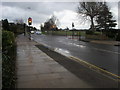
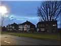
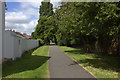
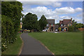
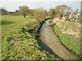

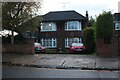
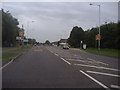
9 photos from this area
Area Information
Key information about the LU3 2AG including its size, population, and administrative classification.
- Area Type
- Postcode
- Area Size
- 1.5 hectares
- Population
- 1655
- Population Density
- 2809 people/km²
House Prices in LU3 2AG
26
Properties
£296,870
Average Sold Price
£93,000
Lowest Price
£522,500
Highest Price
Showing 26 properties
| Address | Type | Beds | Baths | Last Sale Price | Last Sale Date | |
|---|---|---|---|---|---|---|
| 28 Riddy Lane, Luton, LU3 2AG | Detached | 3 | 2 | £400,000 | Oct 2025 | |
| 42 Riddy Lane, Luton, LU3 2AG | Detached | 4 | 1 | £425,000 | Mar 2024 | |
| 14 Riddy Lane, Luton, LU3 2AG | Detached | 4 | 2 | £440,000 | May 2023 | |
| 24 Riddy Lane, Luton, LU3 2AG | Detached | 2 | 1 | £255,000 | Dec 2022 | |
| 10 Riddy Lane, Luton, LU3 2AG | house | - | - | £522,500 | Oct 2022 | |
| 26 Riddy Lane, Luton, LU3 2AG | Detached | 4 | 1 | £425,000 | Mar 2021 | |
| 8D Riddy Lane, Luton, LU3 2AG | Detached | 4 | 1 | £386,000 | Nov 2017 | |
| 18 Riddy Lane, Luton, LU3 2AG | house | - | - | £335,000 | Jun 2016 | |
| 8E Riddy Lane, Luton, LU3 2AG | Detached | 4 | 1 | £366,500 | Apr 2016 | |
| 16 Riddy Lane, Luton, LU3 2AG | Semi-detached | 3 | 1 | £340,000 | Apr 2016 |
Page 1 of 3
Energy Efficiency in LU3 2AG
Amenities
Schools
| Rank | School | Type | Entry gender | Ages |
|---|
Explore more schools in this area
Go to Schools tabDemographics
Household Size
Family (3-5 people)
most common
Accommodation Type
Houses
most common
Tenure
88
majority
Ethnic Group
asian_total
most common
Religion
N/A
most common
Household Composition
N/A
most common
Age
47
median
Adults (30-64 years)
most common
Household Deprivation
N/A
with no deprivation
NS-SEC
38
in Lower managerial occupations
Explore more demographic insights in this area
Go to Demographics tabPlanning
Planning Constraints
- Flood RiskPremium
- Ramsar Wetland SitesPremium
- Area of Outstanding Natural BeautyPremium
- Protected Nature ReservePremium
- Protected WoodlandPremium