Area Overview for LU2 7FG
Photos of LU2 7FG
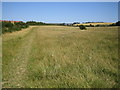
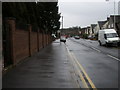
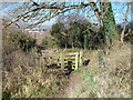
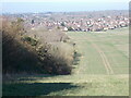
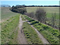
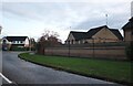
6 photos from this area
Area Information
Key information about the LU2 7FG including its size, population, and administrative classification.
- Area Type
- Postcode
- Area Size
- 2.1 hectares
- Population
- 1724
- Population Density
- 4752 people/km²
House Prices in LU2 7FG
53
Properties
£245,851
Average Sold Price
£69,000
Lowest Price
£575,000
Highest Price
Showing 53 properties
| Address | Type | Beds | Baths | Last Sale Price | Last Sale Date | |
|---|---|---|---|---|---|---|
| 30 Rookery Drive, Luton, LU2 7FG | Semi-detached | 1 | 1 | £215,000 | Feb 2025 | |
| 32 Rookery Drive, Luton, LU2 7FG | Terraced | 2 | 1 | £271,000 | Jan 2025 | |
| 26 Rookery Drive, Luton, LU2 7FG | Terraced | 1 | 1 | £215,000 | Jul 2024 | |
| 2 Rookery Drive, Luton, LU2 7FG | Detached | 4 | 2 | £492,500 | Aug 2023 | |
| 43 Rookery Drive, Luton, LU2 7FG | Terraced | 1 | 1 | £225,000 | Feb 2023 | |
| 52 Rookery Drive, Luton, LU2 7FG | house | - | - | £235,000 | May 2021 | |
| 12 Rookery Drive, Luton, LU2 7FG | house | 4 | - | £510,000 | Jan 2021 | |
| 16 Rookery Drive, Luton, LU2 7FG | house | - | - | £510,000 | Oct 2020 | |
| 33 Rookery Drive, Luton, LU2 7FG | Terraced | 2 | 1 | £205,000 | Apr 2020 | |
| 27 Rookery Drive, Luton, LU2 7FG | Terraced | 2 | 1 | £230,000 | Dec 2019 |
Page 1 of 6
Energy Efficiency in LU2 7FG
Amenities
Schools
| Rank | School | Type | Entry gender | Ages |
|---|
Explore more schools in this area
Go to Schools tabDemographics
Household Size
Family (3-5 people)
most common
Accommodation Type
Houses
most common
Tenure
77
majority
Ethnic Group
White
most common
Religion
N/A
most common
Household Composition
N/A
most common
Age
47
median
Adults (30-64 years)
most common
Household Deprivation
N/A
with no deprivation
NS-SEC
42
in Lower managerial occupations
Explore more demographic insights in this area
Go to Demographics tabPlanning
Planning Constraints
- Flood RiskPremium
- Ramsar Wetland SitesPremium
- Area of Outstanding Natural BeautyPremium
- Protected Nature ReservePremium
- Protected WoodlandPremium