Area Overview for LU2 7BS
Photos of LU2 7BS
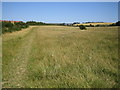
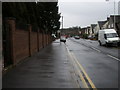
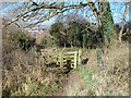
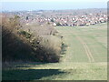
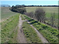
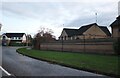
6 photos from this area
Area Information
Key information about the LU2 7BS including its size, population, and administrative classification.
- Area Type
- Postcode
- Area Size
- 2.6 hectares
- Population
- 1724
- Population Density
- 4752 people/km²
House Prices in LU2 7BS
24
Properties
£533,211
Average Sold Price
£145,000
Lowest Price
£850,000
Highest Price
Showing 24 properties
| Address | Type | Beds | Baths | Last Sale Price | Last Sale Date | |
|---|---|---|---|---|---|---|
| 372 Old Bedford Road, Luton, LU2 7BS | house | - | - | £800,000 | Nov 2025 | |
| 394 Old Bedford Road, Luton, LU2 7BS | Detached | 4 | 2 | £850,000 | Jan 2023 | |
| 368 Old Bedford Road, Luton, LU2 7BS | Detached | 3 | 1 | £835,000 | Dec 2022 | |
| 398 Old Bedford Road, Luton, LU2 7BS | house | - | - | £725,000 | Aug 2019 | |
| 376 Old Bedford Road, Luton, LU2 7BS | house | - | - | £720,000 | Jan 2018 | |
| 370 Old Bedford Road, Luton, LU2 7BS | house | - | - | £580,000 | Nov 2017 | |
| 390 Old Bedford Road, Luton, LU2 7BS | Detached | 5 | 3 | £750,000 | Mar 2017 | |
| 354 Old Bedford Road, Luton, LU2 7BS | Detached | 5 | 4 | £485,000 | Jan 2015 | |
| 388 Old Bedford Road, Luton, LU2 7BS | Detached | 4 | 1 | £500,000 | Sep 2014 | |
| 380 Old Bedford Road, Luton, LU2 7BS | Detached | 5 | - | £556,000 | Aug 2014 |
Page 1 of 3
Energy Efficiency in LU2 7BS
Amenities
Schools
| Rank | School | Type | Entry gender | Ages |
|---|
Explore more schools in this area
Go to Schools tabDemographics
Household Size
Family (3-5 people)
most common
Accommodation Type
Houses
most common
Tenure
77
majority
Ethnic Group
White
most common
Religion
N/A
most common
Household Composition
N/A
most common
Age
47
median
Adults (30-64 years)
most common
Household Deprivation
N/A
with no deprivation
NS-SEC
42
in Lower managerial occupations
Explore more demographic insights in this area
Go to Demographics tabPlanning
Planning Constraints
- Flood RiskPremium
- Ramsar Wetland SitesPremium
- Area of Outstanding Natural BeautyPremium
- Protected Nature ReservePremium
- Protected WoodlandPremium