Area Overview for LU2 0TS
Photos of LU2 0TS


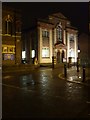
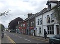
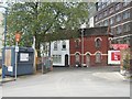


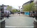
100 photos from this area
Area Information
Key information about the LU2 0TS including its size, population, and administrative classification.
- Area Type
- Postcode
- Area Size
- 1.2 hectares
- Population
- 1809
- Population Density
- 13705 people/km²
House Prices in LU2 0TS
74
Properties
£122,882
Average Sold Price
£36,000
Lowest Price
£275,000
Highest Price
Showing 74 properties
| Address | Type | Beds | Baths | Last Sale Price | Last Sale Date | |
|---|---|---|---|---|---|---|
| 27 Berkeley Path, Luton, LU2 0TS | house | 4 | 2 | £275,000 | May 2025 | |
| 35 Berkeley Path, Luton, LU2 0TS | Flat | - | - | £175,000 | Aug 2024 | |
| 52 Berkeley Path, Luton, LU2 0TS | Flat | - | - | £165,000 | Oct 2021 | |
| 6 Berkeley Path, Luton, LU2 0TS | house | - | - | £240,000 | May 2021 | |
| 34 Berkeley Path, Luton, LU2 0TS | Flat | - | - | £110,000 | Jul 2016 | |
| 29 Berkeley Path, Luton, LU2 0TS | Maisonette | - | - | £125,000 | Nov 2014 | |
| 16 Berkeley Path, Luton, LU2 0TS | house | 4 | - | £152,000 | Feb 2014 | |
| 62 Berkeley Path, Luton, LU2 0TS | Flat | - | - | £85,000 | Feb 2014 | |
| 64 Berkeley Path, Luton, LU2 0TS | house | - | - | £145,000 | Aug 2013 | |
| 23 Berkeley Path, Luton, LU2 0TS | house | - | - | £103,000 | Aug 2012 |
Page 1 of 8
Energy Efficiency in LU2 0TS
Amenities
Schools
| Rank | School | Type | Entry gender | Ages |
|---|
Explore more schools in this area
Go to Schools tabDemographics
Household Size
Two person
most common
Accommodation Type
Flats
most common
Tenure
17
majority
Ethnic Group
White
most common
Religion
N/A
most common
Household Composition
N/A
most common
Age
47
median
Adults (30-64 years)
most common
Household Deprivation
N/A
with no deprivation
NS-SEC
17
in Lower managerial occupations
Explore more demographic insights in this area
Go to Demographics tabPlanning
Planning Constraints
- Flood RiskPremium
- Ramsar Wetland SitesPremium
- Area of Outstanding Natural BeautyPremium
- Protected Nature ReservePremium
- Protected WoodlandPremium