Area Overview for LU2 0TR
Photos of LU2 0TR
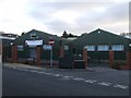
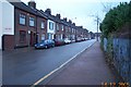
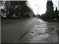
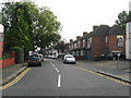
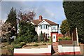
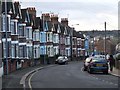
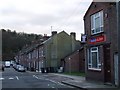
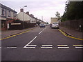
17 photos from this area
Area Information
Key information about the LU2 0TR including its size, population, and administrative classification.
- Area Type
- Postcode
- Area Size
- 9049 m²
- Population
- 1809
- Population Density
- 13705 people/km²
House Prices in LU2 0TR
48
Properties
£100,509
Average Sold Price
£31,500
Lowest Price
£310,000
Highest Price
Showing 48 properties
| Address | Type | Beds | Baths | Last Sale Price | Last Sale Date | |
|---|---|---|---|---|---|---|
| 87 Butterworth Path, Luton, LU2 0TR | Semi-detached | 3 | 2 | £310,000 | Mar 2023 | |
| 92 Butterworth Path, Luton, LU2 0TR | Flat | - | - | £138,000 | Nov 2017 | |
| 60 Butterworth Path, Luton, LU2 0TR | Flat | - | - | £87,000 | Apr 2015 | |
| 66 Butterworth Path, Luton, LU2 0TR | Flat | - | - | £110,000 | Oct 2010 | |
| 62 Butterworth Path, Luton, LU2 0TR | Flat | - | - | £112,000 | Jun 2008 | |
| 67 Butterworth Path, Luton, LU2 0TR | Flat | - | - | £91,000 | Nov 2004 | |
| 84 Butterworth Path, Luton, LU2 0TR | house | - | - | £114,950 | May 2003 | |
| 65 Butterworth Path, Luton, LU2 0TR | Flat | - | - | £54,000 | Jul 2002 | |
| 96 Butterworth Path, Luton, LU2 0TR | Terraced | - | - | £81,000 | May 2002 | |
| 94 Butterworth Path, Luton, LU2 0TR | house | - | - | £36,660 | Feb 2002 |
Page 1 of 5
Energy Efficiency in LU2 0TR
Amenities
Schools
| Rank | School | Type | Entry gender | Ages |
|---|
Explore more schools in this area
Go to Schools tabDemographics
Household Size
Two person
most common
Accommodation Type
Flats
most common
Tenure
17
majority
Ethnic Group
White
most common
Religion
N/A
most common
Household Composition
N/A
most common
Age
47
median
Adults (30-64 years)
most common
Household Deprivation
N/A
with no deprivation
NS-SEC
17
in Lower managerial occupations
Explore more demographic insights in this area
Go to Demographics tabPlanning
Planning Constraints
- Flood RiskPremium
- Ramsar Wetland SitesPremium
- Area of Outstanding Natural BeautyPremium
- Protected Nature ReservePremium
- Protected WoodlandPremium