Area Overview for LU2 0FR
Photos of LU2 0FR
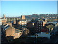
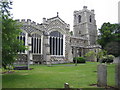


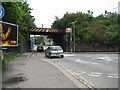
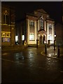
100 photos from this area
Area Information
Key information about the LU2 0FR including its size, population, and administrative classification.
- Area Type
- Postcode
- Area Size
- 1811 m²
- Population
- 1809
- Population Density
- 13705 people/km²
House Prices in LU2 0FR
52
Properties
£136,037
Average Sold Price
£8,400
Lowest Price
£214,000
Highest Price
Showing 52 properties
| Address | Type | Beds | Baths | Last Sale Price | Last Sale Date | |
|---|---|---|---|---|---|---|
| 38, Highview Court, Dudley Street, Luton, LU2 0FR | Flat | - | - | £150,000 | Jul 2023 | |
| 30, Highview Court, Dudley Street, Luton, LU2 0FR | Flat | - | - | £100,000 | May 2023 | |
| 8, Highview Court, Dudley Street, Luton, LU2 0FR | Flat | - | - | £142,500 | Dec 2021 | |
| 18, Highview Court, Dudley Street, Luton, LU2 0FR | Flat | 1 | 1 | £139,000 | Feb 2020 | |
| 32, Highview Court, Dudley Street, Luton, LU2 0FR | Flat | 1 | 1 | £135,000 | Sep 2019 | |
| 11, Highview Court, Dudley Street, Luton, LU2 0FR | Flat | 1 | 1 | £142,000 | Apr 2019 | |
| 44, Highview Court, Dudley Street, Luton, LU2 0FR | Flat | 1 | 1 | £168,000 | Sep 2018 | |
| 10, Highview Court, Dudley Street, Luton, LU2 0FR | Flat | 1 | 1 | £8,400 | Jun 2018 | |
| 49, Highview Court, Dudley Street, Luton, LU2 0FR | Flat | 1 | 1 | £190,000 | May 2018 | |
| 9, Highview Court, Dudley Street, Luton, LU2 0FR | Flat | 2 | - | £157,000 | Apr 2018 |
Page 1 of 6
Energy Efficiency in LU2 0FR
Amenities
Schools
| Rank | School | Type | Entry gender | Ages |
|---|
Explore more schools in this area
Go to Schools tabDemographics
Household Size
Two person
most common
Accommodation Type
Flats
most common
Tenure
17
majority
Ethnic Group
White
most common
Religion
N/A
most common
Household Composition
N/A
most common
Age
47
median
Adults (30-64 years)
most common
Household Deprivation
N/A
with no deprivation
NS-SEC
17
in Lower managerial occupations
Explore more demographic insights in this area
Go to Demographics tabPlanning
Planning Constraints
- Flood RiskPremium
- Ramsar Wetland SitesPremium
- Area of Outstanding Natural BeautyPremium
- Protected Nature ReservePremium
- Protected WoodlandPremium