Area Overview for LU1 5BH
Photos of LU1 5BH
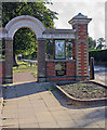
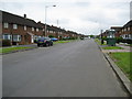
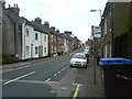
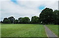
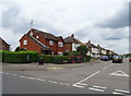
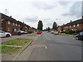
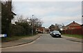
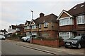
66 photos from this area
Area Information
Key information about the LU1 5BH including its size, population, and administrative classification.
- Area Type
- Postcode
- Area Size
- 3363 m²
- Population
- 2677
- Population Density
- 13749 people/km²
House Prices in LU1 5BH
33
Properties
£162,444
Average Sold Price
£83,500
Lowest Price
£217,000
Highest Price
Showing 33 properties
| Address | Type | Beds | Baths | Last Sale Price | Last Sale Date | |
|---|---|---|---|---|---|---|
| 72 Hastings Street, Luton, LU1 5BH | Terraced | 2 | 1 | £217,000 | Oct 2024 | |
| 82A Hastings Street, Luton, LU1 5BH | Maisonette | 4 | 1 | £185,000 | Mar 2022 | |
| 86 Hastings Street, Luton, LU1 5BH | Terraced | 3 | 1 | £180,000 | Mar 2020 | |
| 68 Hastings Street, Luton, LU1 5BH | Terraced | 2 | 1 | £200,000 | Feb 2017 | |
| 74 Hastings Street, Luton, LU1 5BH | Terraced | 3 | 1 | £174,000 | Nov 2015 | |
| 84 Hastings Street, Luton, LU1 5BH | Terraced | 2 | 1 | £125,000 | Dec 2014 | |
| 66 Hastings Street, Luton, LU1 5BH | Terraced | 2 | - | £147,000 | Dec 2013 | |
| 100 Hastings Street, Luton, LU1 5BH | Flat | 1 | 1 | £83,500 | Apr 2013 | |
| 64 Hastings Street, Luton, LU1 5BH | Terraced | 5 | 1 | £150,500 | Aug 2004 | |
| Flat 4, 78 Hastings Street, Luton, LU1 5BH | Flat | 1 | 1 | - | - |
Page 1 of 4
Energy Efficiency in LU1 5BH
Amenities
Schools
| Rank | School | Type | Entry gender | Ages |
|---|
Explore more schools in this area
Go to Schools tabDemographics
Household Size
One person
most common
Accommodation Type
Flats
most common
Tenure
13
majority
Ethnic Group
White
most common
Religion
N/A
most common
Household Composition
N/A
most common
Age
47
median
Adults (30-64 years)
most common
Household Deprivation
N/A
with no deprivation
NS-SEC
14
in Lower managerial occupations
Explore more demographic insights in this area
Go to Demographics tabPlanning
Planning Constraints
- Flood RiskPremium
- Ramsar Wetland SitesPremium
- Area of Outstanding Natural BeautyPremium
- Protected Nature ReservePremium
- Protected WoodlandPremium