Area Overview for LU1 1TG
Photos of LU1 1TG
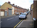

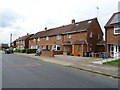
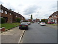

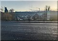
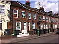
16 photos from this area
Area Information
Key information about the LU1 1TG including its size, population, and administrative classification.
- Area Type
- Postcode
- Area Size
- 1.1 hectares
- Population
- 2567
- Population Density
- 4680 people/km²
House Prices in LU1 1TG
21
Properties
£108,458
Average Sold Price
£34,000
Lowest Price
£360,000
Highest Price
Showing 21 properties
| Address | Type | Beds | Baths | Last Sale Price | Last Sale Date | |
|---|---|---|---|---|---|---|
| 337 Dallow Road, Luton, LU1 1TG | house | - | - | £360,000 | Nov 2025 | |
| 329 Dallow Road, Luton, LU1 1TG | Semi-detached | 3 | 1 | £160,000 | Mar 2015 | |
| 343 Dallow Road, Luton, LU1 1TG | Semi-detached | 5 | 2 | £125,000 | Apr 2010 | |
| 319 Dallow Road, Luton, LU1 1TG | Semi-detached | - | - | £171,000 | Dec 2007 | |
| 317 Dallow Road, Luton, LU1 1TG | house | - | - | £86,000 | Jan 2002 | |
| 351 Dallow Road, Luton, LU1 1TG | Semi-detached | - | - | £70,000 | Nov 2001 | |
| 335 Dallow Road, Luton, LU1 1TG | Semi-detached | - | - | £66,000 | Feb 2001 | |
| 323 Dallow Road, Luton, LU1 1TG | Semi-detached | - | - | £83,000 | Sep 2000 | |
| 345 Dallow Road, Luton, LU1 1TG | Semi-detached | 3 | 2 | £71,000 | Jul 2000 | |
| 331 Dallow Road, Luton, LU1 1TG | Semi-detached | - | - | £35,000 | Oct 1998 |
Page 1 of 3
Energy Efficiency in LU1 1TG
Amenities
Schools
| Rank | School | Type | Entry gender | Ages |
|---|
Explore more schools in this area
Go to Schools tabDemographics
Household Size
Family (3-5 people)
most common
Accommodation Type
Houses
most common
Tenure
49
majority
Ethnic Group
asian_total
most common
Religion
N/A
most common
Household Composition
N/A
most common
Age
22
median
Adults (30-64 years)
most common
Household Deprivation
N/A
with no deprivation
NS-SEC
16
in Lower managerial occupations
Explore more demographic insights in this area
Go to Demographics tabPlanning
Planning Constraints
- Flood RiskPremium
- Ramsar Wetland SitesPremium
- Area of Outstanding Natural BeautyPremium
- Protected Nature ReservePremium
- Protected WoodlandPremium