Area Overview for LU1 1UZ
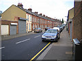
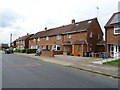
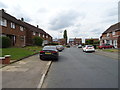
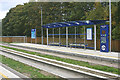
Photos of LU1 1UZ


Area Information
LU1 1UZ is a small, tightly knit residential cluster in England with a population of 2567. Its compact size means the area is easy to navigate, with most amenities and services within walking or cycling distance. The community here is primarily composed of adults aged 30–64, reflecting a mature demographic that prioritises stability. The area’s proximity to Luton Airport and major rail links, including Luton Railway Station and Leagrave Station, makes it a strategic location for commuters and those needing quick access to regional transport. Despite its size, LU1 1UZ offers a blend of practical living with low crime risk and excellent broadband connectivity. The presence of Foxdell Primary School, rated good by Ofsted, adds to its appeal for families. While the area lacks large-scale retail or green spaces, its compact nature ensures a focused, localised lifestyle. For buyers seeking a quiet, low-maintenance home with good infrastructure, LU1 1UZ provides a straightforward option.
- Area Type
- Postcode
- Area Size
- Not available
- Population
- 2567
- Population Density
- 4680 people/km²
LU1 1UZ is a small area with a housing stock dominated by houses rather than flats, reflecting a preference for family-friendly properties. With 49% of homes owned by residents, the market is a mix of owner-occupied and rental properties. The limited size of the area means the housing stock is finite, so buyers may need to look beyond LU1 1UZ for broader options. The absence of planning constraints, such as protected woodlands or AONB designations, suggests flexibility in property development. However, the small population and compact footprint mean the market is unlikely to have high turnover or speculative growth. For those seeking a home in this area, the focus should be on practicality rather than investment potential, given the limited scale of the housing stock.
House Prices in LU1 1UZ
No properties found in this postcode.
Energy Efficiency in LU1 1UZ
The nearest amenities to LU1 1UZ include five retail outlets, such as Aldi Bury and Tesco Luton, offering everyday shopping needs. The area’s rail network provides access to Luton Railway Station and Leagrave Station, which connect to larger towns and cities. London Luton Airport is a notable feature, offering travel convenience. While the data does not mention parks or leisure facilities, the proximity to retail and transport hubs suggests a practical, service-oriented lifestyle. The absence of detailed information on green spaces or dining options means the area’s character is defined by its accessibility and functional amenities rather than cultural or recreational attractions.
Amenities
Schools
Foxdell Primary School is the only school explicitly listed in the data for LU1 1UZ. As a primary school with a good Ofsted rating, it provides a solid foundation for young learners. The absence of secondary schools or other educational institutions in the immediate vicinity means families may need to consider nearby areas for secondary education. For parents prioritising primary schooling, Foxdell’s rating offers reassurance about the quality of early education. However, the lack of additional schools suggests that the area is better suited for families with younger children rather than those requiring a full range of educational facilities.
| Rank | School | Type | Entry gender | Ages |
|---|
Explore more schools in this area
Go to Schools tabDemographics
The population of LU1 1UZ is 2567, with a median age of 22, though the most common age range is adults aged 30–64. This suggests a community skewed toward older, established residents. Home ownership stands at 49%, indicating a mix of owner-occupied properties and rental units. The area is predominantly composed of houses, not flats, which aligns with the higher proportion of family households. The predominant ethnic group is Asian, reflecting a cultural diversity that shapes local traditions and community dynamics. While no specific deprivation data is provided, the low crime risk and access to essential services suggest a relatively stable quality of life. The absence of protected natural areas or planning constraints means development pressures are minimal, preserving the area’s residential character.
Household Size
Accommodation Type
Tenure
Ethnic Group
Religion
Household Composition
Age
Household Deprivation
NS-SEC
Explore more demographic insights in this area
Go to Demographics tabPlanning
Planning Constraints
- Flood RiskPremium
- Ramsar Wetland SitesPremium
- Area of Outstanding Natural BeautyPremium
- Protected Nature ReservePremium
- Protected WoodlandPremium