Area Overview for IP33 2ET
Photos of IP33 2ET
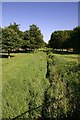
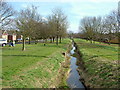

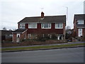
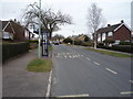
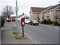
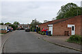
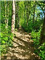
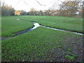
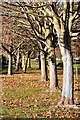
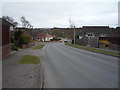
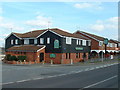
14 photos from this area
Area Information
Key information about the IP33 2ET including its size, population, and administrative classification.
- Area Type
- Postcode
- Area Size
- 1.2 hectares
- Population
- 1451
- Population Density
- 3122 people/km²
House Prices in IP33 2ET
39
Properties
£166,246
Average Sold Price
£50,500
Lowest Price
£267,000
Highest Price
Showing 39 properties
| Address | Type | Beds | Baths | Last Sale Price | Last Sale Date | |
|---|---|---|---|---|---|---|
| 47 Sherborne Road, Bury St Edmunds, IP33 2ET | house | - | - | £240,000 | Mar 2023 | |
| 116 Sherborne Road, Bury St Edmunds, IP33 2ET | Semi-detached | 2 | 1 | £230,000 | Mar 2023 | |
| 51 Sherborne Road, Bury St Edmunds, IP33 2ET | house | - | - | £267,000 | Jan 2022 | |
| 41 Sherborne Road, Bury St Edmunds, IP33 2ET | house | - | - | £250,000 | Apr 2021 | |
| 132 Sherborne Road, Bury St Edmunds, IP33 2ET | Bungalow | - | - | £225,000 | Dec 2020 | |
| 90 Sherborne Road, Bury St Edmunds, IP33 2ET | Semi-detached | - | - | £208,000 | Sep 2019 | |
| 55 Sherborne Road, Bury St Edmunds, IP33 2ET | house | 3 | - | £230,000 | Jun 2018 | |
| 124 Sherborne Road, Bury St Edmunds, IP33 2ET | Semi-detached | 2 | - | £217,000 | Dec 2017 | |
| 37 Sherborne Road, Bury St Edmunds, IP33 2ET | house | - | - | £240,000 | Mar 2016 | |
| 94 Sherborne Road, Bury St Edmunds, IP33 2ET | house | - | - | £190,000 | Mar 2016 |
Page 1 of 4
Energy Efficiency in IP33 2ET
Amenities
Schools
| Rank | School | Type | Entry gender | Ages |
|---|
Explore more schools in this area
Go to Schools tabDemographics
Household Size
Two person
most common
Accommodation Type
Houses
most common
Tenure
86
majority
Ethnic Group
White
most common
Religion
N/A
most common
Household Composition
N/A
most common
Age
47
median
Adults (30-64 years)
most common
Household Deprivation
N/A
with no deprivation
NS-SEC
35
in Lower managerial occupations
Explore more demographic insights in this area
Go to Demographics tabPlanning
Planning Constraints
- Flood RiskPremium
- Ramsar Wetland SitesPremium
- Area of Outstanding Natural BeautyPremium
- Protected Nature ReservePremium
- Protected WoodlandPremium