Area Overview for IP33 2ER
Photos of IP33 2ER


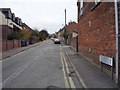
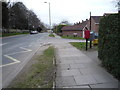
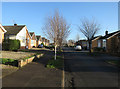

59 photos from this area
Area Information
Key information about the IP33 2ER including its size, population, and administrative classification.
- Area Type
- Postcode
- Area Size
- 7937 m²
- Population
- 1451
- Population Density
- 3122 people/km²
House Prices in IP33 2ER
16
Properties
£159,023
Average Sold Price
£58,750
Lowest Price
£245,000
Highest Price
Showing 16 properties
| Address | Type | Beds | Baths | Last Sale Price | Last Sale Date | |
|---|---|---|---|---|---|---|
| 80 Sherborne Road, Bury St Edmunds, IP33 2ER | Semi-detached | 2 | 1 | £215,000 | Mar 2021 | |
| 66 Sherborne Road, Bury St Edmunds, IP33 2ER | house | - | - | £242,000 | Jun 2020 | |
| 84 Sherborne Road, Bury St Edmunds, IP33 2ER | Semi-detached | - | - | £220,000 | Dec 2017 | |
| 33 Sherborne Road, Bury St Edmunds, IP33 2ER | Semi-detached | 3 | 1 | £245,000 | Dec 2017 | |
| 86 Sherborne Road, Bury St Edmunds, IP33 2ER | Bungalow | - | - | £185,000 | Sep 2015 | |
| 70 Sherborne Road, Bury St Edmunds, IP33 2ER | Detached | - | - | £158,000 | Aug 2009 | |
| 82 Sherborne Road, Bury St Edmunds, IP33 2ER | Semi-detached | - | - | £160,000 | Nov 2005 | |
| 64 Sherborne Road, Bury St Edmunds, IP33 2ER | house | - | - | £131,500 | May 2002 | |
| 74 Sherborne Road, Bury St Edmunds, IP33 2ER | Bungalow | - | - | £66,000 | Jul 1998 | |
| 68 Sherborne Road, Bury St Edmunds, IP33 2ER | Detached | - | - | £68,000 | Feb 1997 |
Page 1 of 2
Energy Efficiency in IP33 2ER
Amenities
Schools
| Rank | School | Type | Entry gender | Ages |
|---|
Explore more schools in this area
Go to Schools tabDemographics
Household Size
Two person
most common
Accommodation Type
Houses
most common
Tenure
86
majority
Ethnic Group
White
most common
Religion
N/A
most common
Household Composition
N/A
most common
Age
47
median
Adults (30-64 years)
most common
Household Deprivation
N/A
with no deprivation
NS-SEC
35
in Lower managerial occupations
Explore more demographic insights in this area
Go to Demographics tabPlanning
Planning Constraints
- Flood RiskPremium
- Ramsar Wetland SitesPremium
- Area of Outstanding Natural BeautyPremium
- Protected Nature ReservePremium
- Protected WoodlandPremium