Area Overview for IP32 7HE
Photos of IP32 7HE
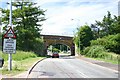
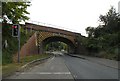
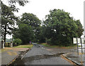
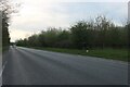
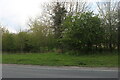
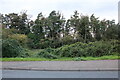
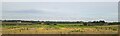
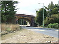
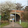
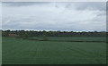
21 photos from this area
Area Information
Key information about the IP32 7HE including its size, population, and administrative classification.
- Area Type
- Postcode
- Area Size
- 3.6 hectares
- Population
- 1309
- Population Density
- 5131 people/km²
House Prices in IP32 7HE
67
Properties
£160,683
Average Sold Price
£35,250
Lowest Price
£485,000
Highest Price
Showing 67 properties
| Address | Type | Beds | Baths | Last Sale Price | Last Sale Date | |
|---|---|---|---|---|---|---|
| 3 Codling Road, Bury St Edmunds, IP32 7HE | Detached | 2 | 3 | £485,000 | Jun 2025 | |
| 83 Codling Road, Bury St Edmunds, IP32 7HE | Terraced | 1 | 1 | £180,000 | Jan 2025 | |
| Mossleigh, 23 Codling Road, Bury St Edmunds, IP32 7HE | Terraced | 2 | 1 | £233,000 | Jul 2024 | |
| 135 Codling Road, Bury St Edmunds, IP32 7HE | Detached | 4 | 2 | £320,000 | May 2024 | |
| 51 Codling Road, Bury St Edmunds, IP32 7HE | Terraced | 2 | 1 | £243,000 | May 2024 | |
| 101 Codling Road, Bury St Edmunds, IP32 7HE | Maisonette | 1 | 1 | £168,000 | Feb 2024 | |
| 127 Codling Road, Bury St Edmunds, IP32 7HE | Detached | 3 | 2 | £285,000 | Nov 2023 | |
| 119 Codling Road, Bury St Edmunds, IP32 7HE | house | 2 | 1 | £250,000 | Jun 2022 | |
| 11 Codling Road, Bury St Edmunds, IP32 7HE | Terraced | 2 | - | £240,000 | Feb 2022 | |
| 137 Codling Road, Bury St Edmunds, IP32 7HE | Detached | 4 | 1 | £347,500 | Feb 2022 |
Page 1 of 7
Energy Efficiency in IP32 7HE
Amenities
Schools
| Rank | School | Type | Entry gender | Ages |
|---|
Explore more schools in this area
Go to Schools tabDemographics
Household Size
Two person
most common
Accommodation Type
Houses
most common
Tenure
65
majority
Ethnic Group
White
most common
Religion
N/A
most common
Household Composition
N/A
most common
Age
47
median
Adults (30-64 years)
most common
Household Deprivation
N/A
with no deprivation
NS-SEC
45
in Lower managerial occupations
Explore more demographic insights in this area
Go to Demographics tabPlanning
Planning Constraints
- Flood RiskPremium
- Ramsar Wetland SitesPremium
- Area of Outstanding Natural BeautyPremium
- Protected Nature ReservePremium
- Protected WoodlandPremium