Area Overview for IP30 0PT
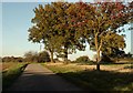
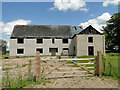
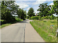
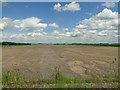
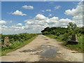
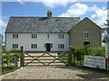
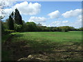
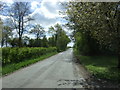
Photos of IP30 0PT


Area Information
Living in IP30 0PT means being part of a small, tightly knit residential cluster in rural England. With a population of 2149 spread across 81.6 hectares, the area has a low density of 69 people per square kilometre, offering a quiet, spacious environment. The community is predominantly composed of adults aged 30–64, reflecting a mature demographic with strong ties to local amenities. Daily life here is shaped by proximity to essential services, including two primary schools and a network of rail stations within walking distance. The area’s compact size fosters a sense of familiarity, though its small footprint means residents often rely on nearby towns for broader retail and leisure options. IP30 0PT is not a high-density commuter hub but a place where homes are primarily owner-occupied, with 79% of residents living in their own properties. This suggests a stable, long-term community, where the majority of housing is in traditional family homes rather than apartments or rentals. For those seeking a peaceful, low-traffic lifestyle with access to basic infrastructure, this postcode offers a blend of seclusion and practicality.
- Area Type
- Postcode
- Area Size
- 81.6 hectares
- Population
- 2149
- Population Density
- 69 people/km²
The property market in IP30 0PT is characterised by high home ownership (79%) and a focus on traditional housing. With no data on rental properties, it is safe to assume this is not a significant rental market, though the small size of the area means the housing stock is limited. The predominance of houses over flats indicates a community where larger, family-oriented homes are the norm. This is typical of rural or semi-rural areas where land availability allows for single-family residences. For buyers, this means a market where properties are likely to be owner-occupied and not frequently changing hands. The limited size of the postcode also means that the immediate surroundings may hold more options, particularly for those seeking variety in property types. However, the small footprint of IP30 0PT itself suggests that buyers should consider nearby areas for a broader selection of homes, while still benefiting from the local amenities and low population density.
House Prices in IP30 0PT
Showing 6 properties
| Address | Type | Beds | Baths | Last Sale Price | Last Sale Date | |
|---|---|---|---|---|---|---|
| Castle Farm, Brettenham Road, Felsham, IP30 0PT | Farm | 6 | - | £970,000 | Jun 2020 | |
| Thistle House, Brettenham Road, Felsham, IP30 0PT | Detached | - | - | £489,000 | Apr 2014 | |
| Castle Farm, Brettenham Road, Felsham, IP30 0PT | Detached | - | - | - | - | |
| Castle Farm Barn, Brettenham Road, Felsham, IP30 0PT | Detached | - | - | - | - | |
| Castle Cottage, Brettenham Road, Felsham, IP30 0PT | Detached | - | - | - | - | |
| Castle Lodge, Brettenham Road, Felsham, IP30 0PT | Detached | - | - | - | - |
Energy Efficiency in IP30 0PT
The lifestyle in IP30 0PT is shaped by its proximity to practical amenities, including five retail outlets such as East of England Co-operative Co and Co-op Lavenham. These shops provide basic grocery and household needs, though the selection is limited compared to larger towns. The area’s rail connectivity offers access to regional hubs, while RAF Wattisham, though not a civilian transport option, may provide a sense of local significance. For leisure, the lack of detailed data on parks or recreational facilities suggests that outdoor activities may require venturing beyond the postcode. However, the low population density and small size of the area imply a quiet, low-traffic environment ideal for those seeking simplicity. The combination of nearby shops, rail links, and a peaceful setting makes IP30 0PT suitable for individuals who prioritise convenience over extensive leisure options.
Amenities
Schools
Residents of IP30 0PT have access to two primary schools within practical reach: Rattlesden Church of England Voluntary Controlled School and Rattlesden Church of England Primary Academy. Both institutions serve the local community, with the latter holding an Ofsted rating of 'good'. This ensures families have reliable options for early education, though no secondary schools are listed in the data. The presence of two primary schools suggests a focus on foundational education, which is critical for young families. However, parents seeking secondary schooling may need to look further afield. The mix of school types—both under the Church of England—indicates a community with established educational preferences. For those prioritising primary education, the availability of two schools with a strong rating is a clear advantage, though the absence of secondary options should be considered in long-term planning.
| Rank | School | Type | Entry gender | Ages |
|---|
Explore more schools in this area
Go to Schools tabDemographics
The demographic profile of IP30 0PT is defined by a median age of 47, with the majority of residents falling within the 30–64 age range. This indicates a community of established adults, many likely in their prime working years or nearing retirement. Home ownership is high, at 79%, with the predominant type of accommodation being houses rather than flats or apartments. This suggests a preference for single-family living, which aligns with the area’s low population density. The ethnic composition is overwhelmingly White, reflecting the broader trends of rural England. While no specific deprivation data is provided, the high home ownership rate and stable age distribution imply a relatively secure economic environment. However, the absence of younger families or students may mean the area lacks the vibrancy of more diverse communities. For buyers, this demographic suggests a market where properties are likely to remain in private hands for extended periods, with limited turnover.
Household Size
Accommodation Type
Tenure
Ethnic Group
Religion
Household Composition
Age
Household Deprivation
NS-SEC
Explore more demographic insights in this area
Go to Demographics tabPlanning
Planning Constraints
- Flood RiskPremium
- Ramsar Wetland SitesPremium
- Area of Outstanding Natural BeautyPremium
- Protected Nature ReservePremium
- Protected WoodlandPremium