Area Overview for IP30 0PS
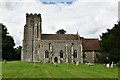
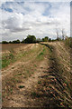
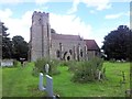
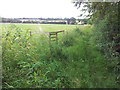
Photos of IP30 0PS
Area Information
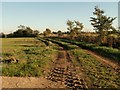
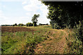
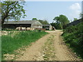
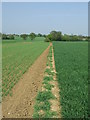
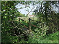
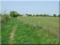
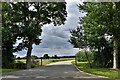
Living in IP30 0PS offers a quiet, small-scale residential experience in a compact postcode area spanning 90.8 hectares. With a population of 2149, it is a low-density community, averaging 69 people per square kilometre. The area’s character is defined by its modest size and the presence of family-oriented housing. Residents here are predominantly adults aged 30–64, with a median age of 47, suggesting a stable, established population. Daily life is shaped by proximity to local amenities, including retail stores, rail links, and primary schools. The area’s small footprint means it is not densely populated, offering a sense of space without urban sprawl. While it lacks major landmarks or cultural hubs, its appeal lies in its simplicity and accessibility to nearby towns and services. For those seeking a peaceful, low-maintenance lifestyle, IP30 0PS provides a snapshot of rural England, where community ties are strong and the pace of life is measured.
- Area Type
- Postcode
- Area Size
- 90.8 hectares
- Population
- 2149
- Population Density
- 69 people/km²
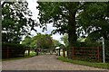
The property market in IP30 0PS is dominated by owner-occupied homes, with 79% of residents living in properties they own. The accommodation type is predominantly houses, which is typical for a low-density, rural postcode area. This suggests a market where family homes and single-family residences are the norm, rather than apartments or shared housing. Given the small size of the area, the housing stock is limited, meaning buyers should consider the local market’s constraints and proximity to nearby towns for additional options. The high home ownership rate indicates a community that values long-term investment in property, with little reliance on rental markets. For buyers, this means a focus on existing homes rather than new developments, though the small footprint of IP30 0PS may limit availability.
House Prices in IP30 0PS
No properties found in this postcode.
Energy Efficiency in IP30 0PS
The lifestyle in IP30 0PS is shaped by its proximity to practical amenities, including five retail outlets such as East of England Co-operative Co and Co-op Lavenham. These shops provide access to groceries and daily essentials, supporting a self-sufficient local economy. The area’s rail network, with stations at Elmswell, Entrance, and Thurston, connects residents to broader regional services. Nearby, RAF Wattisham adds a layer of local significance, potentially offering employment or community events. While the area lacks large-scale leisure facilities, its small size ensures that essential services are within walking or short driving distance. This combination of retail, transport, and local landmarks creates a functional, low-stress environment for residents.
Amenities
Schools
Residents of IP30 0PS have access to two primary schools: Rattlesden Church of England Voluntary Controlled School and Rattlesden Church of England Primary Academy. Both institutions serve the local community, providing education for younger children. The second school holds an Ofsted rating of “good,” which reflects a satisfactory standard of teaching and facilities. The presence of two primary schools within the area offers families options for their children’s early education, though no secondary schools are listed in the data. This mix of schools caters to the needs of families with young children but does not extend to older students, who may need to commute to nearby towns for secondary education.
| Rank | School | Type | Entry gender | Ages |
|---|---|---|---|---|
| 1 | Rattlesden Church of England Voluntary Controlled School | primary | N/A | N/A |
| 2 | Rattlesden Church of England Primary Academy | primary | N/A | N/A |
Explore more schools in this area
Go to Schools tabDemographics
The community in IP30 0PS is predominantly composed of adults aged 30–64, making up the most common age range. With a median age of 47, the area reflects a mature demographic, suggesting a population settled in long-term housing. Home ownership is high, at 79%, indicating that most residents live in properties they own rather than rent. The accommodation type is primarily houses, which aligns with the area’s low population density and suburban character. The predominant ethnic group is White, though no further breakdown of diversity is provided. The population density of 69 people per square kilometre is low, which may contribute to a quieter, more spread-out living environment. This data suggests a community focused on stability, with a strong presence of family homes and limited pressure from transient populations.
Household Size
Accommodation Type
Tenure
Ethnic Group
Religion
Household Composition
Age
Household Deprivation
NS-SEC
Explore more demographic insights in this area
Go to Demographics tabPlanning
Planning Constraints
- Flood RiskPremium
- Ramsar Wetland SitesPremium
- Area of Outstanding Natural BeautyPremium
- Protected Nature ReservePremium
- Protected WoodlandPremium
- Crime RiskPremium