Area Overview for IP3 9WN
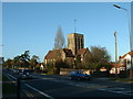
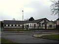
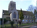
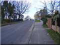
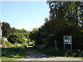
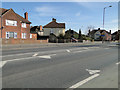
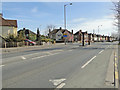
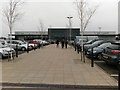
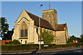
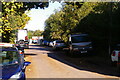
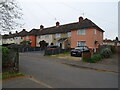
Photos of IP3 9WN

Area Information
Living in IP3 9WN means being part of a tightly knit, small-scale residential cluster in England. The area covers 3,681 square metres and is home to 1,785 people, resulting in a population density of 484,980 per square kilometre. This high density suggests a compact, closely connected community, though the area remains focused on residential living rather than commercial or industrial use. IP3 9WN is not a sprawling suburb but a defined postcode area with a distinct character. Daily life here is likely shaped by proximity to local amenities and a reliance on nearby transport links. The area’s small size means it is likely bordered by other similarly sized postcode clusters, creating a network of interconnected residential zones. For those considering a home here, the compact nature of the area may offer a sense of familiarity and ease of navigation, though the high density could influence the pace of life and availability of private space.
- Area Type
- Postcode
- Area Size
- 3681 m²
- Population
- 1785
- Population Density
- 4394 people/km²
The property market in IP3 9WN is characterised by a low home ownership rate of 37%, which suggests that the majority of properties are occupied by renters rather than owners. The accommodation type is primarily houses, which implies that the area consists of standalone homes rather than flats or apartments. This combination of low ownership and house-based housing stock may indicate a rental-heavy market where landlords dominate. For buyers, this dynamic could mean limited availability of properties for purchase, as the market is skewed toward tenancy. The small size of the area—just 3,681 square metres—means that the housing stock is concentrated, and buyers may need to consider nearby postcode areas for more options. Those seeking a home here may find it more practical to focus on rental properties or explore adjacent regions with a broader range of housing types.
House Prices in IP3 9WN
Showing 14 properties
| Address | Type | Beds | Baths | Last Sale Price | Last Sale Date | |
|---|---|---|---|---|---|---|
| 13 Cheshire Close, Ipswich, IP3 9WN | Bungalow | - | - | - | - | |
| 4 Cheshire Close, Ipswich, IP3 9WN | house | - | - | - | - | |
| 9 Cheshire Close, Ipswich, IP3 9WN | Bungalow | - | - | - | - | |
| 14 Cheshire Close, Ipswich, IP3 9WN | Bungalow | - | - | - | - | |
| 3 Cheshire Close, Ipswich, IP3 9WN | house | - | - | - | - | |
| 6 Cheshire Close, Ipswich, IP3 9WN | house | - | - | - | - | |
| 11 Cheshire Close, Ipswich, IP3 9WN | Bungalow | - | - | - | - | |
| 10 Cheshire Close, Ipswich, IP3 9WN | Bungalow | - | - | - | - | |
| 2 Cheshire Close, Ipswich, IP3 9WN | house | - | - | - | - | |
| 1 Cheshire Close, Ipswich, IP3 9WN | house | - | - | - | - |
Energy Efficiency in IP3 9WN
Residents of IP3 9WN have access to a range of nearby amenities within practical reach. Retail options include Sainsburys Warren, Waitrose Ipswich, and the East of England Co-operative Co, providing a mix of supermarket and local shopping choices. The area is also served by multiple rail stations, including Derby Road Railway Station and entrances 2 and 3, facilitating easy travel to and from the area. While the data does not mention parks or leisure facilities, the presence of retail and transport hubs suggests a functional lifestyle focused on convenience. The proximity to major retailers and railway links likely supports a daily routine that balances household needs with commuting. For those prioritising accessibility, the combination of shops and rail access makes IP3 9WN a practical choice for those who value ease of movement and availability of essential services.
Amenities
Schools
| Rank | School | Type | Entry gender | Ages |
|---|
Explore more schools in this area
Go to Schools tabDemographics
The community in IP3 9WN is predominantly middle-aged, with a median age of 47 and the most common age range being adults aged 30–64. This suggests a population that is largely established, with fewer young families or retirees. Home ownership here is relatively low at 37%, indicating that a majority of residents are likely renting. The primary accommodation type is houses, which contrasts with the lower home ownership rate, hinting at a rental market where properties are more commonly occupied by tenants than owners. The predominant ethnic group is White, reflecting a homogenous demographic profile. The data does not indicate significant diversity in terms of ethnicity or household composition. With 37% of homes owned, the area may offer opportunities for renters seeking stability, though buyers may find the market more competitive due to limited owner-occupied stock.
Household Size
Accommodation Type
Tenure
Ethnic Group
Religion
Household Composition
Age
Household Deprivation
NS-SEC
Explore more demographic insights in this area
Go to Demographics tabPlanning
Planning Constraints
- Flood RiskPremium
- Ramsar Wetland SitesPremium
- Area of Outstanding Natural BeautyPremium
- Protected Nature ReservePremium
- Protected WoodlandPremium