Area Overview for IP3 9WH
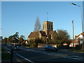
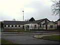
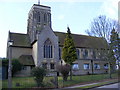
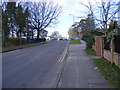
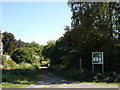
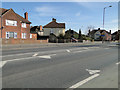
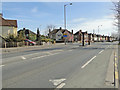
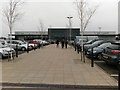
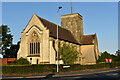
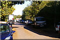
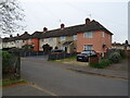
Photos of IP3 9WH

Area Information
Living in IP3 9WH means being part of a tightly knit residential cluster in eastern England, where 1,785 people reside across 1.2 hectares. The area’s compact size fosters a sense of familiarity, with homes predominantly in single-family houses. The population density of 150,703 people per square kilometre reflects a mix of long-term residents and those drawn to the area’s practicality. Daily life here is shaped by proximity to retail and transport hubs, with Sainsburys Warren and Derby Road Railway Station within easy reach. The median age of 47 suggests a mature community, with many residents in their 30s to 60s. While the area lacks natural constraints like protected woodlands or AONBs, it benefits from low flood risk and strong broadband connectivity. For those seeking a balance between urban convenience and a quieter residential setting, IP3 9WH offers a compact, functional environment.
- Area Type
- Postcode
- Area Size
- 1.2 hectares
- Population
- 1785
- Population Density
- 4394 people/km²
The property market in IP3 9WH is defined by a 37% home ownership rate, suggesting that a significant portion of the housing stock is rented. The area is dominated by houses rather than flats, which may indicate a preference for larger, more traditional homes. This makes IP3 9WH an attractive option for buyers seeking single-family residences, though the small area size of 1.2 hectares means the housing stock is limited. The presence of nearby rail stations, such as Derby Road Railway Station, could enhance the area’s appeal for commuters. However, the low home ownership rate implies competition for available properties, particularly for those prioritising ownership over renting. Buyers should consider the compact nature of the area and its proximity to amenities when evaluating the local market.
House Prices in IP3 9WH
Showing 34 properties
| Address | Type | Beds | Baths | Last Sale Price | Last Sale Date | |
|---|---|---|---|---|---|---|
| 12 Malcolm Road, Ipswich, IP3 9WH | house | - | - | - | - | |
| 34 Malcolm Road, Ipswich, IP3 9WH | house | - | - | - | - | |
| 10 Malcolm Road, Ipswich, IP3 9WH | house | - | - | - | - | |
| 8 Malcolm Road, Ipswich, IP3 9WH | house | - | - | - | - | |
| 54 Malcolm Road, Ipswich, IP3 9WH | house | - | - | - | - | |
| 40 Malcolm Road, Ipswich, IP3 9WH | house | - | - | - | - | |
| 46 Malcolm Road, Ipswich, IP3 9WH | house | - | - | - | - | |
| 48 Malcolm Road, Ipswich, IP3 9WH | house | - | - | - | - | |
| 5 Malcolm Road, Ipswich, IP3 9WH | house | - | - | - | - | |
| 16 Malcolm Road, Ipswich, IP3 9WH | house | - | - | - | - |
Energy Efficiency in IP3 9WH
IP3 9WH offers a range of amenities within practical reach, including retail options like Sainsburys Warren, Waitrose Ipswich, and the East of England Co-operative Co. These shops provide everyday essentials, supporting a convenient lifestyle. The presence of five rail stations, including Derby Road Railway Station, ensures easy access to public transport, facilitating both local and regional travel. While the area does not feature parks or leisure facilities in its immediate vicinity, the proximity to retail hubs and rail networks suggests a focus on practicality over expansive recreational spaces. The cluster of amenities caters to daily needs, though residents may need to venture further for more specialised services. The combination of shopping and transport options makes IP3 9WH a functional choice for those prioritising accessibility.
Amenities
Schools
| Rank | School | Type | Entry gender | Ages |
|---|
Explore more schools in this area
Go to Schools tabDemographics
The community in IP3 9WH is predominantly composed of adults aged 30–64, with a median age of 47. This suggests a stable population with a focus on family and established careers. Home ownership stands at 37%, indicating a mix of owner-occupied properties and rental homes, though the exact proportion of renters is not specified. The area is characterised by houses rather than flats, which may appeal to those prioritising private outdoor space. The predominant ethnic group is White, with no data provided on other demographics. The relatively high population density, combined with the age profile, points to a community that values proximity to services and infrastructure over expansive green spaces. Quality of life here is likely influenced by the availability of nearby retail and transport options, though the lack of cultural or ethnic diversity data limits deeper analysis.
Household Size
Accommodation Type
Tenure
Ethnic Group
Religion
Household Composition
Age
Household Deprivation
NS-SEC
Explore more demographic insights in this area
Go to Demographics tabPlanning
Planning Constraints
- Flood RiskPremium
- Ramsar Wetland SitesPremium
- Area of Outstanding Natural BeautyPremium
- Protected Nature ReservePremium
- Protected WoodlandPremium