Area Overview for IP3 9WF
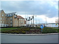
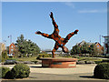
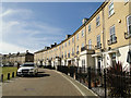
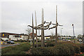
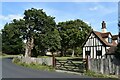
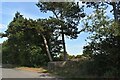
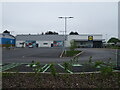
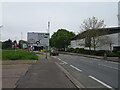
Photos of IP3 9WF


Area Information
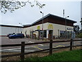
IP3 9WF is a compact residential cluster in England, covering 9.7 hectares and home to 1,685 residents. The area’s high population density—793 people per square kilometre—suggests a tightly knit community, though its small size means it is not a sprawling suburb. The postcode sits within an Area of Outstanding Natural Beauty, offering residents proximity to protected landscapes without compromising on urban convenience. Daily life here is shaped by its mix of local amenities and natural surroundings. The presence of Derby Road Railway Station and Shotley Point Marina Ferry Landing ensures connectivity to nearby towns and coastal routes. While the area lacks large retail hubs, five retail outlets, including Lidl Crane and East of England Co-operative Co, provide essential shopping options. The median age of 47 and a population skewed toward adults aged 30–64 suggest a mature, stable demographic, with a focus on established living rather than transient populations.
- Area Type
- Postcode
- Area Size
- 9.7 hectares
- Population
- 1685
- Population Density
- 793 people/km²
The property market in IP3 9WF is characterised by a 53% home ownership rate, with houses being the dominant accommodation type. This suggests a market skewed toward owner-occupied homes rather than rental properties, though the relatively low home ownership rate indicates some reliance on private rentals. The small area size—just 9.7 hectares—means the housing stock is limited, likely comprising a mix of older and newer properties. For buyers, this presents a challenge: competition for available homes may be fierce, and the immediate surroundings are critical for finding additional options. The presence of railway stations and a ferry landing suggests that properties here are often sought by those prioritising transport links over expansive gardens or larger living spaces. Prospective buyers should consider the area’s compact nature when evaluating long-term suitability.
House Prices in IP3 9WF
Showing 24 properties
| Address | Type | Beds | Baths | Last Sale Price | Last Sale Date | |
|---|---|---|---|---|---|---|
| 11 Dunwich Close, Ipswich, IP3 9WF | Detached | 6 | 4 | £725,000 | Mar 2025 | |
| 21 Dunwich Close, Ipswich, IP3 9WF | Detached | 6 | 1 | £830,000 | Feb 2023 | |
| 1 Dunwich Close, Ipswich, IP3 9WF | Detached | 5 | 4 | £550,000 | Aug 2022 | |
| 19 Dunwich Close, Ipswich, IP3 9WF | Detached | 4 | 2 | £420,000 | Mar 2021 | |
| 8 Dunwich Close, Ipswich, IP3 9WF | house | - | - | £465,000 | Feb 2021 | |
| 5 Dunwich Close, Ipswich, IP3 9WF | Detached | 5 | 2 | £495,000 | Jan 2021 | |
| 6 Dunwich Close, Ipswich, IP3 9WF | house | - | - | £465,000 | Nov 2020 | |
| 7 Dunwich Close, Ipswich, IP3 9WF | Detached | 5 | 3 | £460,000 | Sep 2018 | |
| 2 Dunwich Close, Ipswich, IP3 9WF | Detached | 5 | - | £445,000 | Aug 2017 | |
| 15 Dunwich Close, Ipswich, IP3 9WF | Detached | 5 | - | £375,000 | Dec 2015 |
Energy Efficiency in IP3 9WF
Living in IP3 9WF offers a blend of local convenience and natural beauty. Five retail outlets, including Lidl Crane and East of England Co-operative Co, provide essential shopping, while the proximity to Derby Road Railway Station and Shotley Point Marina Ferry Landing ensures easy access to nearby amenities. The area’s inclusion in an Area of Outstanding Natural Beauty means residents can enjoy nearby landscapes, though the small postcode size limits on-site parks. The ferry service to Shotley Point Marina adds a maritime dimension to daily life, offering opportunities for leisure activities. The compact nature of the area means amenities are within practical reach, though the lack of larger retail or entertainment hubs may require trips to nearby towns. Overall, the lifestyle here balances local convenience with the appeal of natural surroundings.
Amenities
Schools
| Rank | School | Type | Entry gender | Ages |
|---|
Explore more schools in this area
Go to Schools tabDemographics
The community in IP3 9WF is predominantly composed of adults aged 30–64, with a median age of 47. This indicates a population largely in their prime working years, with fewer young families or retirees compared to other areas. Home ownership stands at 53%, slightly below the national average, suggesting a mix of owner-occupied properties and rental units. The accommodation type is primarily houses, reflecting a preference for single-family homes over flats. The predominant ethnic group is White, with no data provided on other ethnicities. The area’s population density—793 people per square kilometre—means residents live in close proximity, fostering a sense of community but also requiring efficient local services. The lack of specific data on deprivation or income levels means the quality of life can only be inferred from the availability of amenities and safety assessments.
Household Size
Accommodation Type
Tenure
Ethnic Group
Religion
Household Composition
Age
Household Deprivation
NS-SEC
Explore more demographic insights in this area
Go to Demographics tabPlanning
Planning Constraints
- Flood RiskPremium
- Ramsar Wetland SitesPremium
- Area of Outstanding Natural BeautyPremium
- Protected Nature ReservePremium
- Protected WoodlandPremium